Difference between revisions of "File:ChinaHighBridgeMap.jpg"
From HighestBridges.com
Jump to navigationJump to search (uploaded a new version of "File:ChinaHighBridgeMap.jpg": China High Bridge map by Eric Sakowski / HighestBridges.com) |
(uploaded a new version of "File:ChinaHighBridgeMap.jpg": China High Bridge Map by Eric Sakowski / HighestBridges.com) |
| (One intermediate revision by the same user not shown) | |
(No difference)
| |
Latest revision as of 07:22, 5 January 2010
Map of Western China showing the location of approximately 40 of the countries' highest bridges. They make up nearly half of the world's 100 highest bridges. By 2020, Western China may have more high bridges than every other country on earth combined!
File history
Click on a date/time to view the file as it appeared at that time.
| Date/Time | Thumbnail | Dimensions | User | Comment | |
|---|---|---|---|---|---|
| current | 07:22, 5 January 2010 | 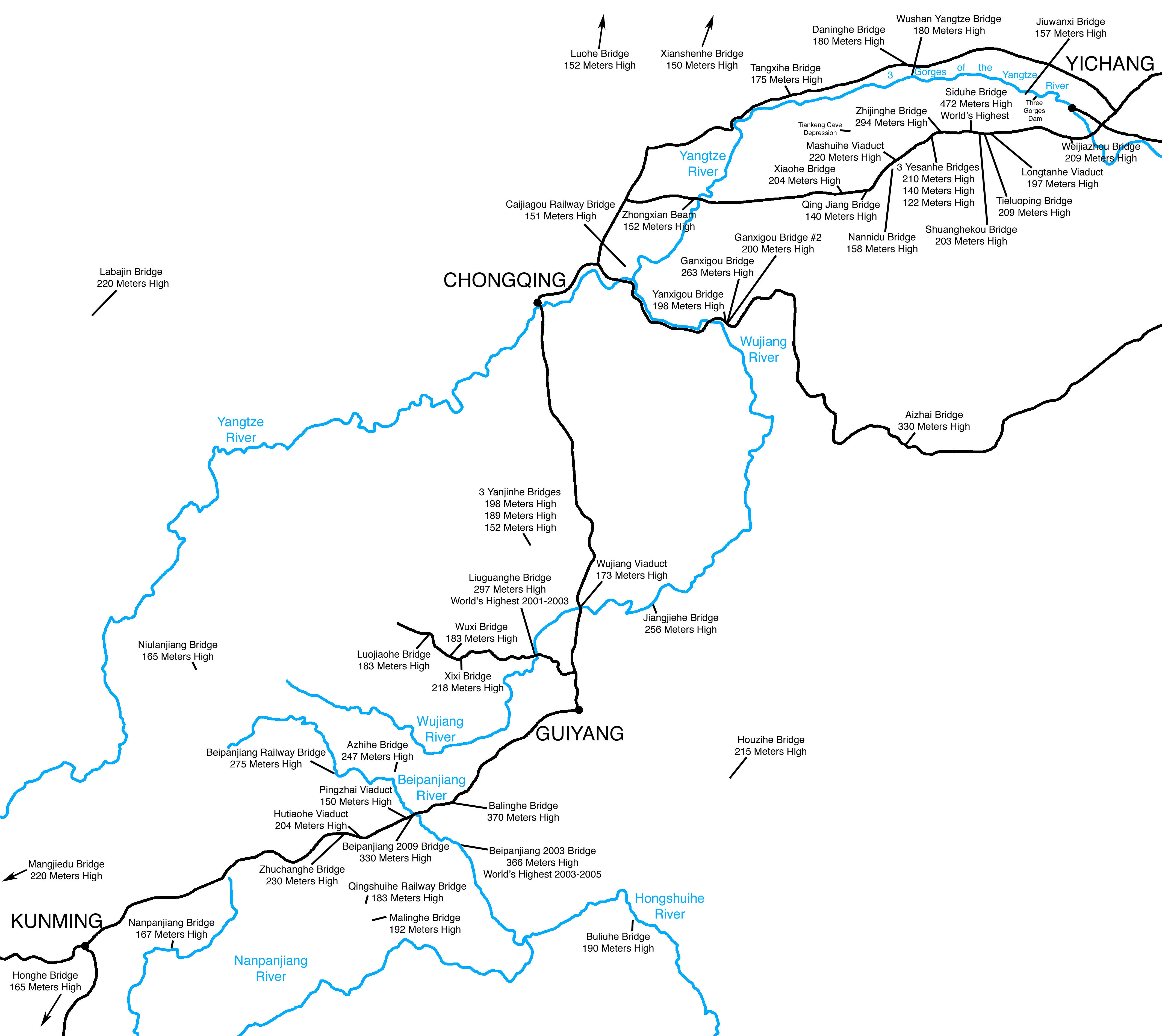 | 4,254 × 3,792 (1.14 MB) | Sakowski (talk | contribs) | China High Bridge Map by Eric Sakowski / HighestBridges.com |
You cannot overwrite this file.
File usage
The following 2 pages use this file: