File:TakachihoMap2.png
From HighestBridges.com
Jump to navigationJump to search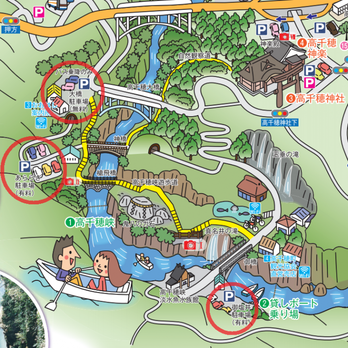
Size of this preview: 600 × 600 pixels. Other resolutions: 240 × 240 pixels | 710 × 710 pixels.
Original file (710 × 710 pixels, file size: 731 KB, MIME type: image/png)
Takachiho Bridges map.
File history
Click on a date/time to view the file as it appeared at that time.
| Date/Time | Thumbnail | Dimensions | User | Comment | |
|---|---|---|---|---|---|
| current | 05:04, 7 July 2020 | | 710 × 710 (731 KB) | Sakowski (talk | contribs) | Takachiho Bridges map. |
You cannot overwrite this file.
File usage
There are no pages that use this file.