Difference between revisions of "San Marcos Bridge"
(Created page with '<div style="font-size: 25px; text-align: center;"> Bicentenario Bridge / Baluarte Bridge<br /> Puente Bicentenario / Puente Baluarte<br /> El Palmito, Sinaloa, Mexico<br /> 1,280…') |
|||
| (54 intermediate revisions by the same user not shown) | |||
| Line 1: | Line 1: | ||
<div style="font-size: 25px; text-align: center;"> | <div style="font-size: 25px; text-align: center;"> | ||
| − | + | San Marcos Bridge<br /> | |
| − | Puente | + | Puente San Marcos<br /> |
| − | + | Xicotepec de Juárez, Puebla, Mexico<br /> | |
| − | + | 722 feet high / 220 meters high<br /> | |
| − | + | 591 foot span / 180 meter span<br /> | |
| − | + | 2013<br /> | |
| − | [[File: | + | [[File:SanMarcByJoseM.Saa.jpg|750px|center]] |
</div> | </div> | ||
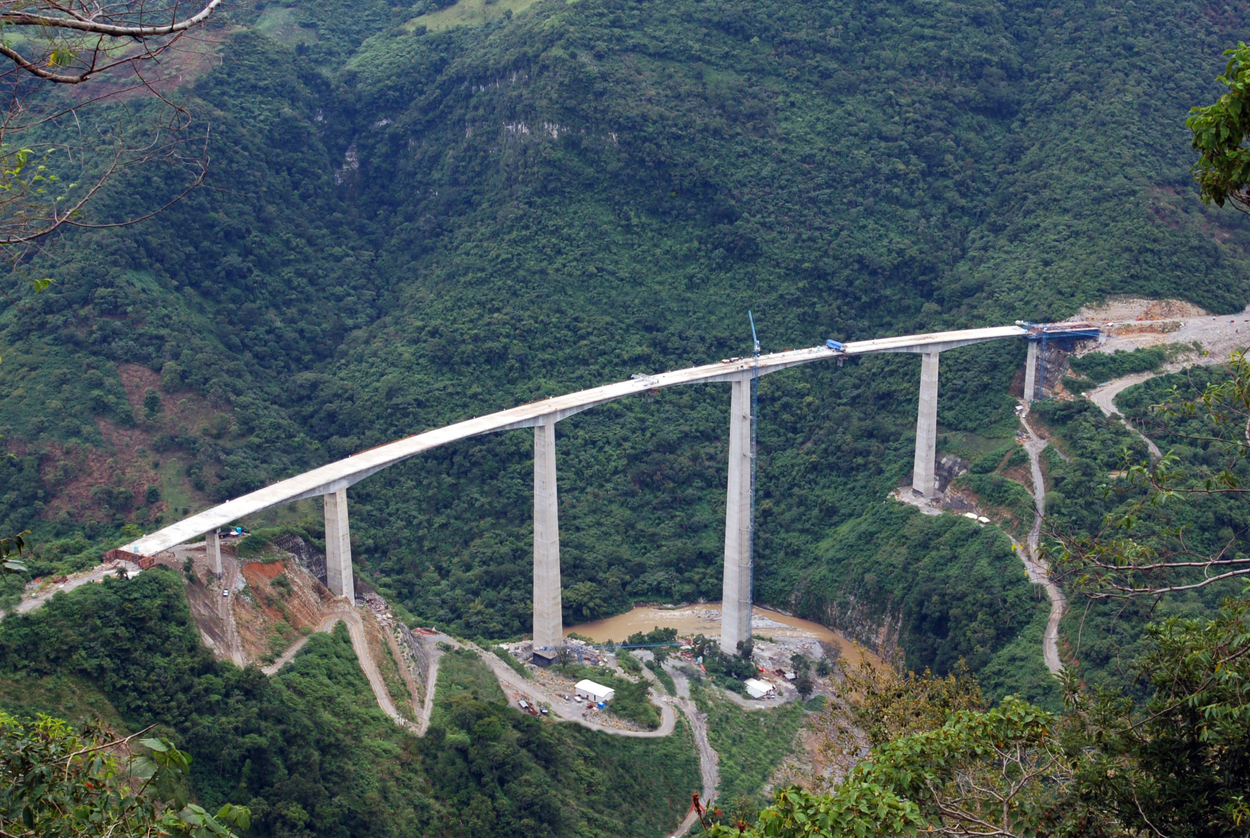
| − | + | Completed in 2013, the soaring San Marcos bridge is the largest and tallest bridge on the final Nuevo Necaxa-Tihuatlán section of the México-Tuxpan highway now under construction. Extending from Mexico City to the Gulf of Mexico, the first and last thirds of the 182 mile (293 km) highway were finished in 2005. The difficulty in completing the highway lied in the central Nuevo Necaxa–Ávila Camacho section that runs for 23 miles (37 kms) along the mountainous San Marcos River gorge. To push the modern carretera through the steep terrain, the engineers had to construct 6 tunnels and several high bridges. Three of these spans exceed 100 meters in height including Xicotepec, San Marcos and Texcapa Bridge, which was completed in 2005. | |
| + | |||
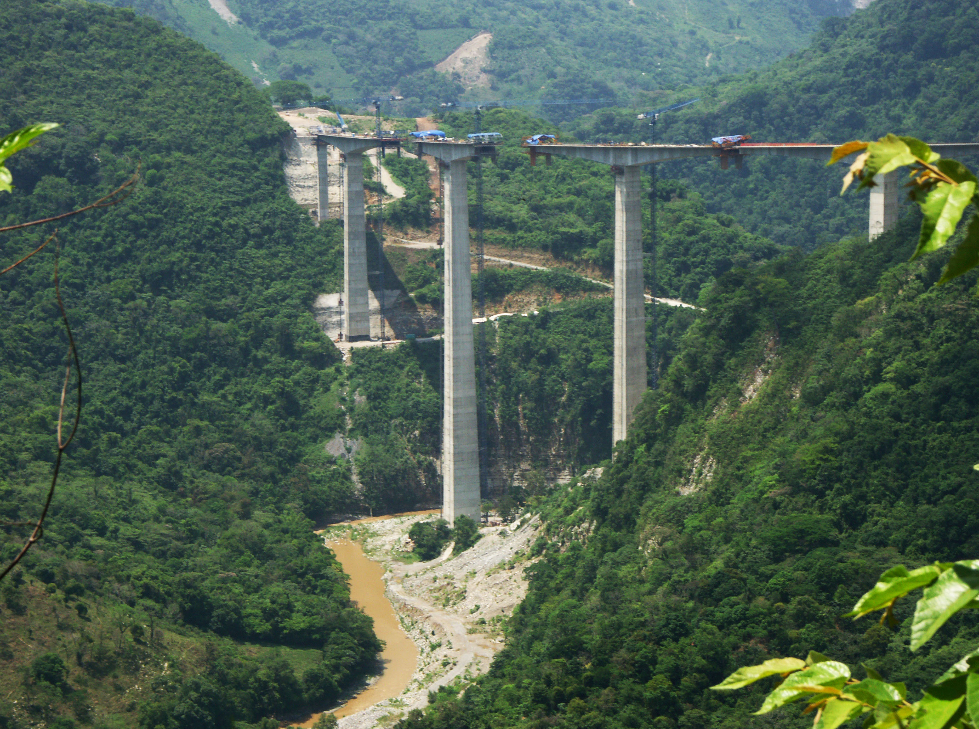
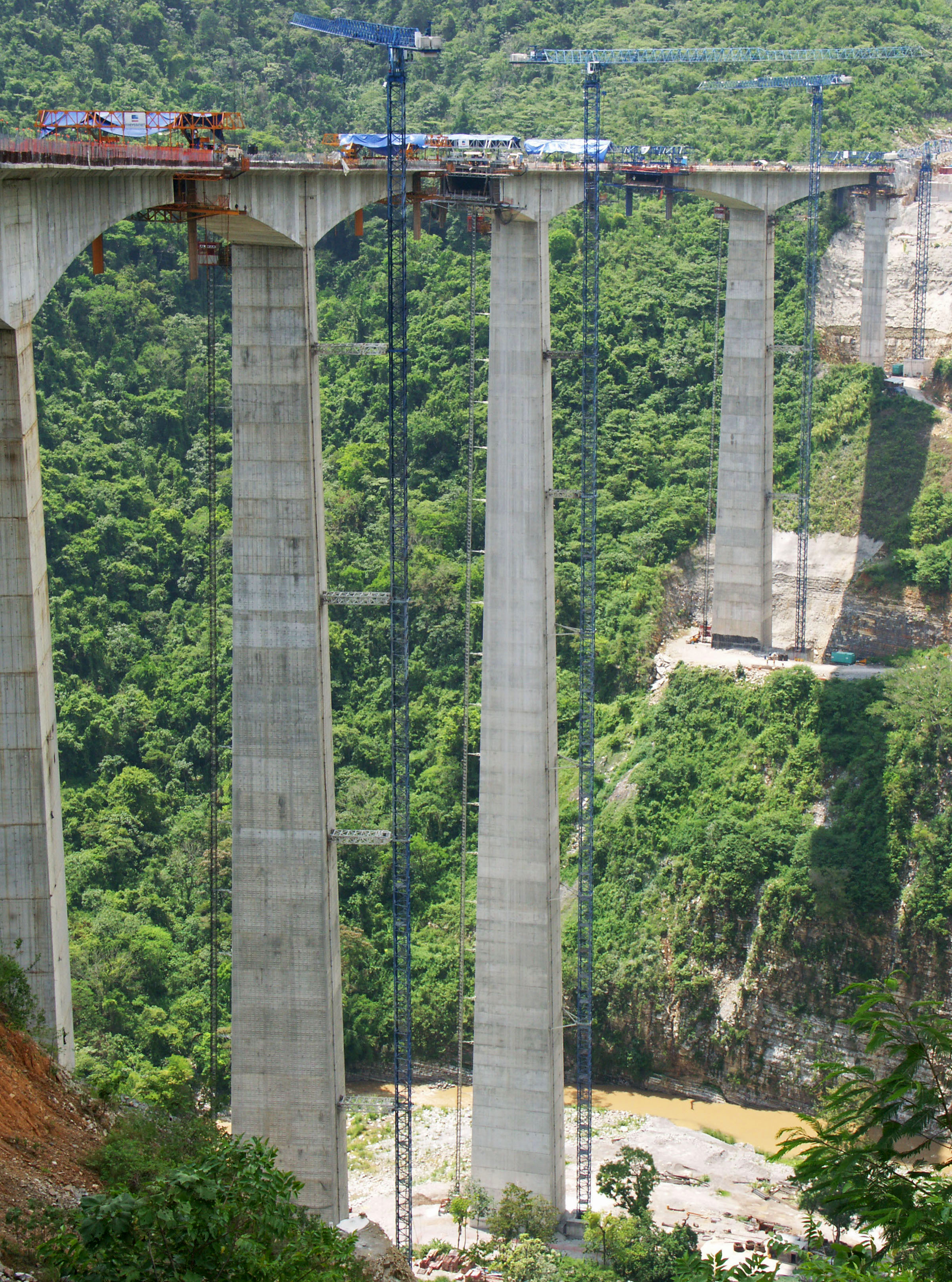
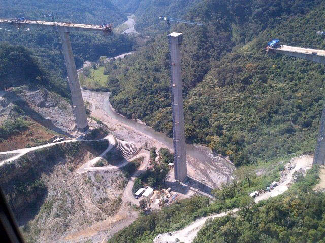
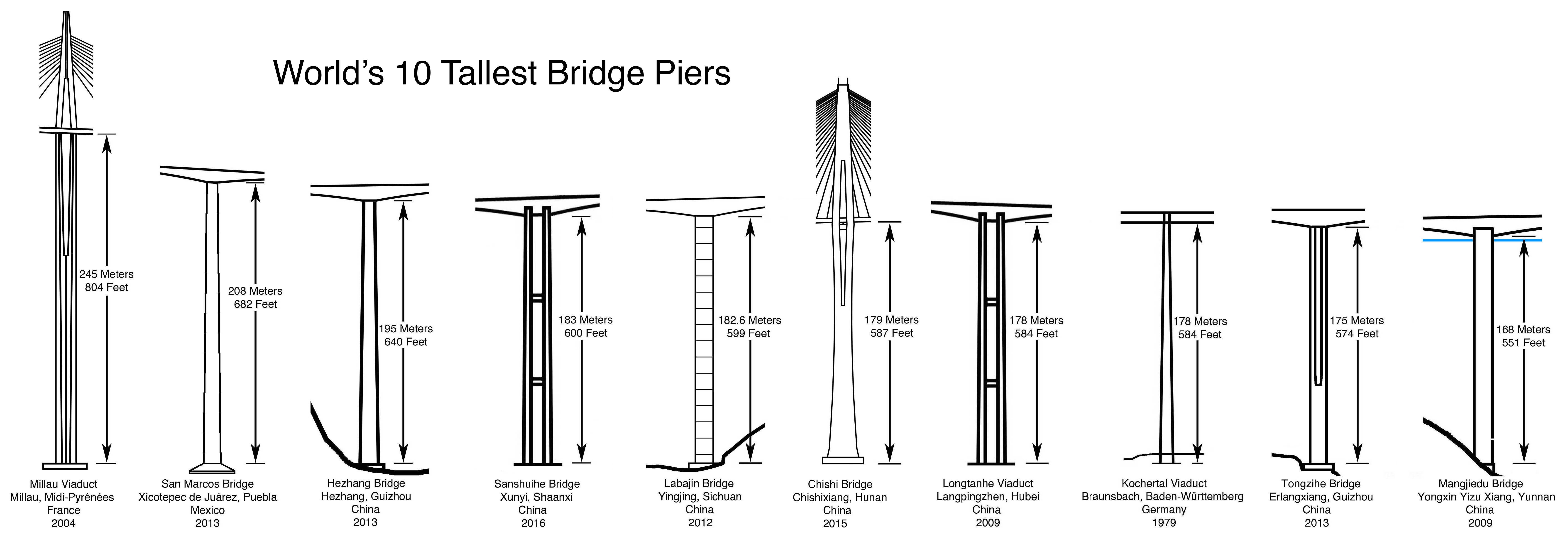
| + | Curving 722 feet (220 meters) above the San Marcos River, the giant prestressed concrete beam viaduct has the second highest bridge pier in the world after the Millau Viaduct in France. Rising 682 feet (208 meters) from the top of the foundation to the underside of the beam, pier number 4 is 100 feet (30 meters) higher than those on either the Longtanhe, Akaishi or Kochertal viaducts in China and Germany. | ||
| − | + | Interestingly, the original design for the San Marcos River crossing was for a fin back bridge. A prestressed beam bridge with a highly variable depth of prestressing, the fin back is unique for having the internal cables at their highest as they pass over the piers, enclosed in a wall or “fin” of concrete. The hump-like profile may look similar to a cable stayed or extradosed bridge but the engineering has more in common with a beam bridge. Many consider the lower profile to be more attractive than a conventional prestressed beam bridge. Mexico has two other large fin back bridges including the Texcapa bridge which is also located on the México-Tuxpan highway and the Papagayo bridge located on the México City-Acapulco highway. | |
| − | + | The first fin back bridge was built in Nuremberg, Germany for a commuter railway in 1969. In the U.S., the only one is the 1987-built Barton Creek bridge near Austin, Texas with a main span of 340 feet (103.5 mtrs). | |
| − | |||
| − | |||
<div style="text-align: center; font-size: 25px;"> | <div style="text-align: center; font-size: 25px;"> | ||
| − | [[File: | + | [[File:SanMarcosElevFinal.jpg|900px|center]]<br /> |
| − | + | San Marcos Bridge Elevation<br /> | |
| + | </div> | ||
| + | |||
| + | |||
| + | [[File:SanMarcosViaduct.jpg|750px|center]] | ||
| + | Image by Eric Sakowski / HighestBridges.com | ||
| + | |||
| + | |||
| + | [[File:SanMarcosBridge.jpg|450px|center]] | ||
| + | Image by Eric Sakowski / HighestBridges.com | ||
| + | |||
| + | |||
| + | [[File:SanMarcosFelipeCalderon.jpg|750px|center]] | ||
| + | Image by SCT. | ||
| + | |||
| + | |||
| + | <div style="font-size: 25px; text-align: center;"> | ||
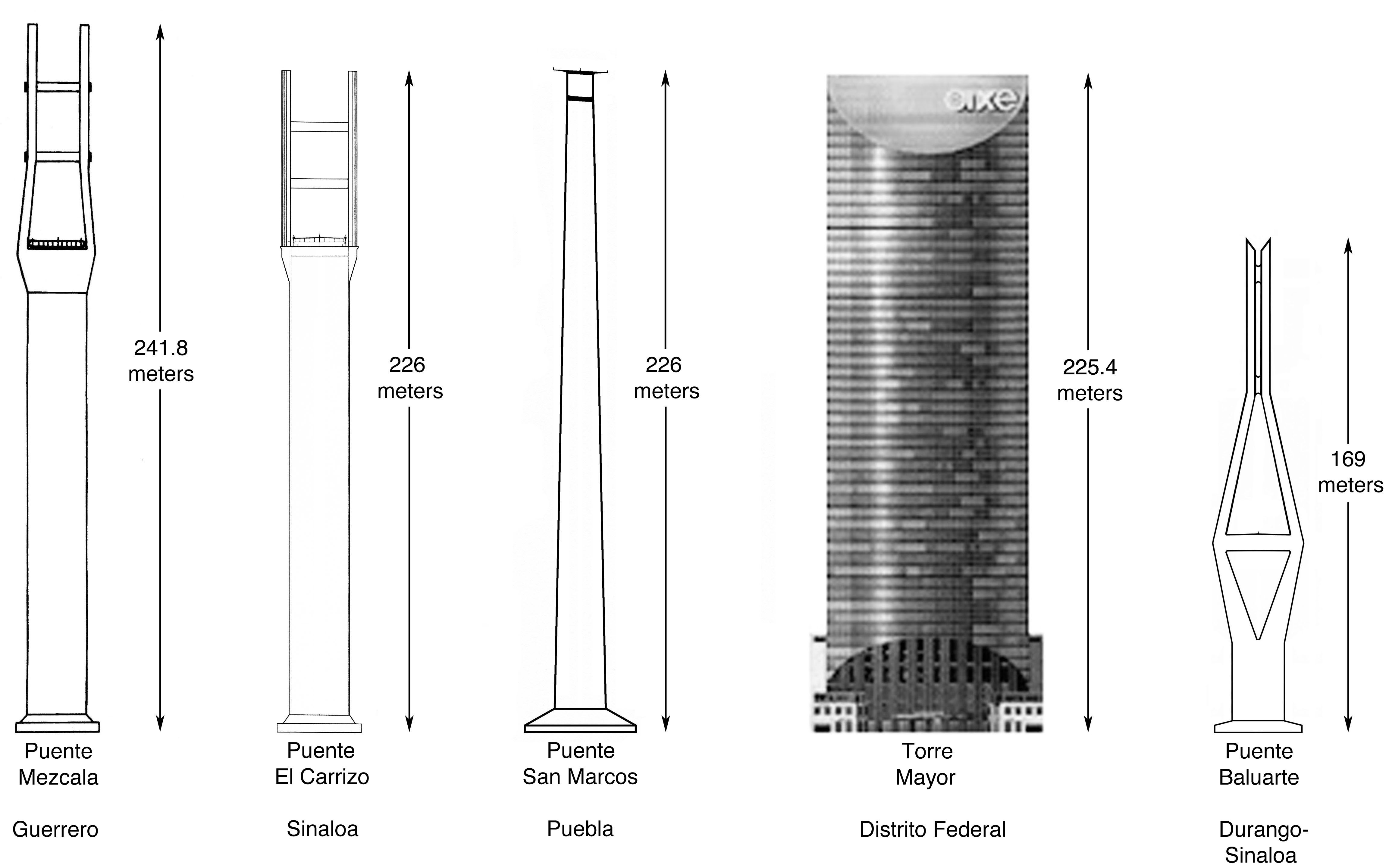
| + | The Tallest Bridges of Mexico and the Torre Mayor Skyscraper<br /> | ||
</div> | </div> | ||
| − | [[File: | + | [[File:MezcalaTowerComparisonFinal.jpg|750px|center]] |
| − | Image by | + | Diagram by Eric Sakowski / HighestBridges.com |
| + | |||
| + | |||
| + | [[File:SanMarcosSecreteria.jpg|750px|center]] | ||
| + | Image by SCT. | ||
| + | |||
| + | |||
| + | [[File:SanMarcosPierSCT.jpg|750px|center]] | ||
| + | Image by SCT. | ||
| + | |||
| + | |||
| + | [[File:SanMarcosPierConstructionSchedule.jpg|450px|center]] | ||
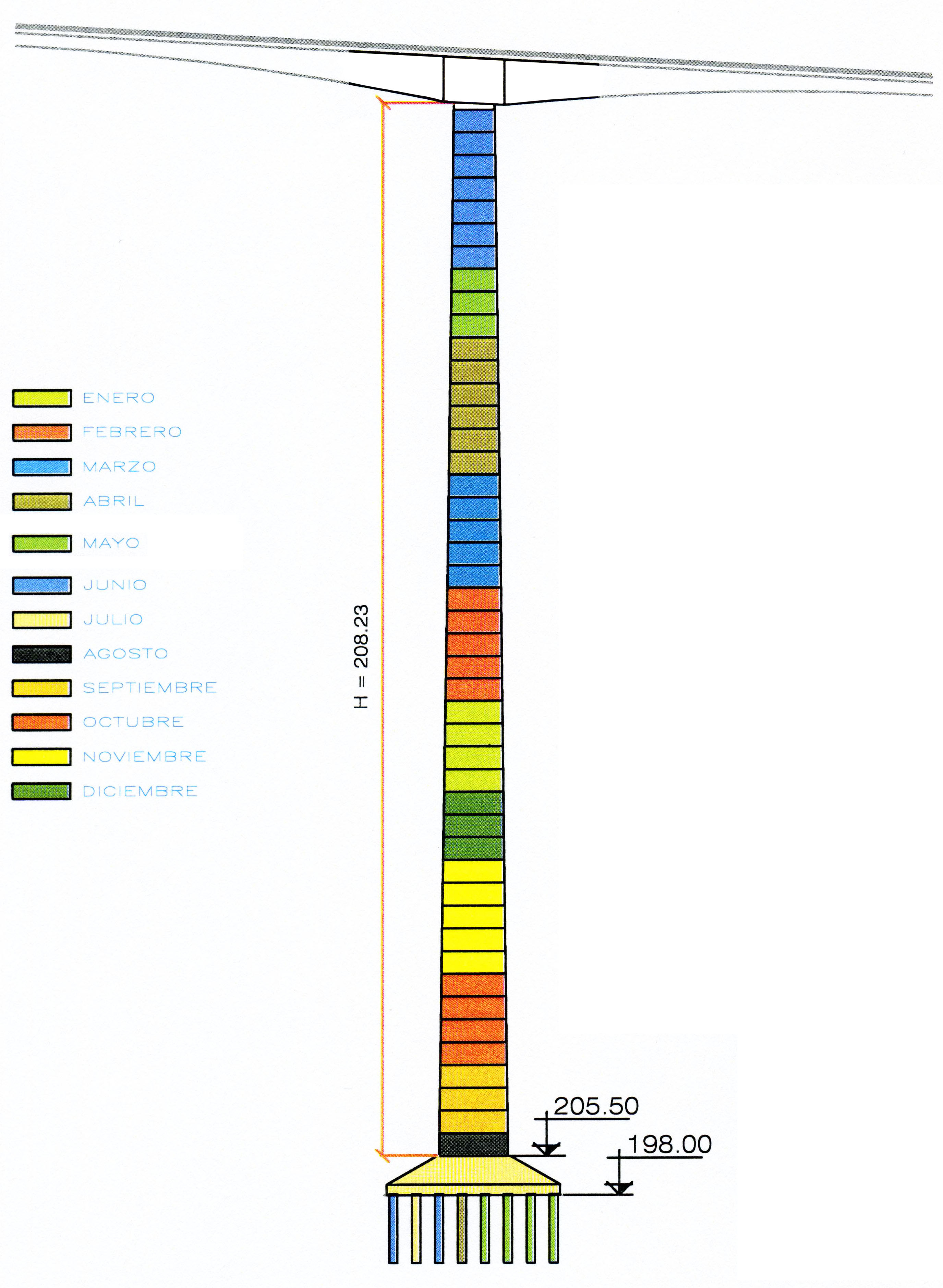
| + | Construction schedule of the world's second tallest pier on the San Marcos Bridge. | ||
| + | |||
| + | |||
| + | [[File:SanMarcosHighestPierBase.jpg|450px|center]] | ||
| + | Image by Eric Sakowski / HighestBridges.com | ||
| + | |||
| + | |||
| + | [[File:SanMarcosPierBaseFamilia.jpg|750px|center]] | ||
| + | Image by Eric Sakowski / HighestBridges.com | ||
| + | |||
| + | |||
| + | [[File:SanMarcosVicenteGayosso.jpg|450px|center]] | ||
| + | Image by Vicente Gayosso. | ||
| + | |||
| + | |||
| + | [[File:10TallestBridges.jpg|1000px|center]] | ||
| + | |||
| + | |||
| + | [[File:10HighestPiers.jpg|1000px|center]] | ||
| + | |||
| + | |||
| + | [[File:10HighestBridges.jpg|1000px|center]] | ||
| + | |||
| + | |||
| + | [[File:SanMarcosPier4Base.jpg|750px|center]] | ||
| + | Image by SCT. | ||
| + | |||
| + | |||
| + | [[File:SanMarcosPier4Base2.jpg|750px|center]] | ||
| + | Image by SCT. | ||
| + | |||
| + | |||
| + | [[File:SanMarcosPier4Base3.jpg|750px|center]] | ||
| + | Image by SCT. | ||
| + | |||
| + | |||
| + | [[File:SanMarcosPier4Base4.jpg|750px|center]] | ||
| + | Image by SCT. | ||
| + | |||
| + | |||
| + | [[File:SanMarcosLiftTrack.jpg|450px|center]] | ||
| + | Image by Eric Sakowski / HighestBridges.com | ||
| + | |||
| + | |||
| + | [[File:SanMarcosPierElevator2.jpg|750px|center]] | ||
| + | Image by Eric Sakowski / HighestBridges.com | ||
| + | |||
| + | |||
| + | [[File:SanMarcosExcavation.jpg|750px|center]] | ||
| + | Slope excavation process for one of the piers on San Marcos Bridge. Image by SCT. | ||
| + | |||
| + | |||
| + | [[File:SanMarcosApproachPier.jpg|450px|center]] | ||
| + | Image by Eric Sakowski / HighestBridges.com | ||
| + | |||
| + | |||
| + | [[File:SanMarcosPier&Elevator.jpg|750px|center]] | ||
| + | Image by Eric Sakowski / HighestBridges.com | ||
| + | |||
| + | |||
| + | [[File:SanMarcosDeckCross.jpg|750px|center]] | ||
| + | San Marcos Bridge deck cross section. | ||
| + | |||
| + | |||
| + | [[File:SanMarcosBeamGap.jpg|450px|center]] | ||
| + | Image by Eric Sakowski / HighestBridges.com | ||
| + | |||
| + | |||
| + | [[File:SanMarcosDeckCurve.jpg|750px|center]] | ||
| + | Image by Eric Sakowski / HighestBridges.com | ||
| + | |||
| + | |||
| + | [[File:SanMarcosPier&Cliff2.jpg|450px|center]] | ||
| + | Image by Eric Sakowski / HighestBridges.com | ||
| + | |||
| + | |||
| + | [[File:SanMarcosLowerPierLonglens.jpg|750px|center]] | ||
| + | Image by Eric Sakowski / HighestBridges.com | ||
| + | |||
| + | |||
| + | [[File:SanMarcosLonglens3.jpg|750px|center]] | ||
| + | Image by Eric Sakowski / HighestBridges.com | ||
| + | |||
| + | |||
| + | [[File:San Marcos niebla.jpg|750px|center]] | ||
| + | |||
| + | |||
| + | [[File:SanMarcosUpperHalf.jpg|750px|center]] | ||
| + | Image by Eric Sakowski / HighestBridges.com | ||
| + | |||
| + | |||
| + | [[File:SanMarcosPierView2.jpg|450px|center]] | ||
| + | Image by Eric Sakowski / HighestBridges.com | ||
| + | |||
| + | |||
| + | [[File:SanMarcosSideView.jpg|750px|center]] | ||
| + | Image by Eric Sakowski / HighestBridges.com | ||
| + | |||
| + | |||
| + | [[File:SanMarcosSlopeSupport.jpg|750px|center]] | ||
| + | Image by Eric Sakowski / HighestBridges.com | ||
| + | |||
| + | |||
| + | [[File:SanMarcosSouthApproach.jpg|750px|center]] | ||
| + | Image by Eric Sakowski / HighestBridges.com | ||
| + | |||
| + | |||
| + | [[File:SanMarcosSouthEnd.jpg|750px|center]] | ||
| + | Image by Eric Sakowski / HighestBridges.com | ||
| + | |||
| + | |||
| + | [[File:SanMarcosTendon.jpg|750px|center]] | ||
| + | Image by Eric Sakowski / HighestBridges.com | ||
| + | |||
| + | |||
| + | [[File:SanMarcosTraveler.jpg|750px|center]] | ||
| + | Image by Eric Sakowski / HighestBridges.com | ||
| + | |||
| + | |||
| + | [[File:SanMarcosSuspension2.jpg|750px|center]] | ||
| + | Image by Eric Sakowski / HighestBridges.com | ||
| + | |||
| + | |||
| + | [[File:SanMarcosSuspension4.jpg|750px|center]] | ||
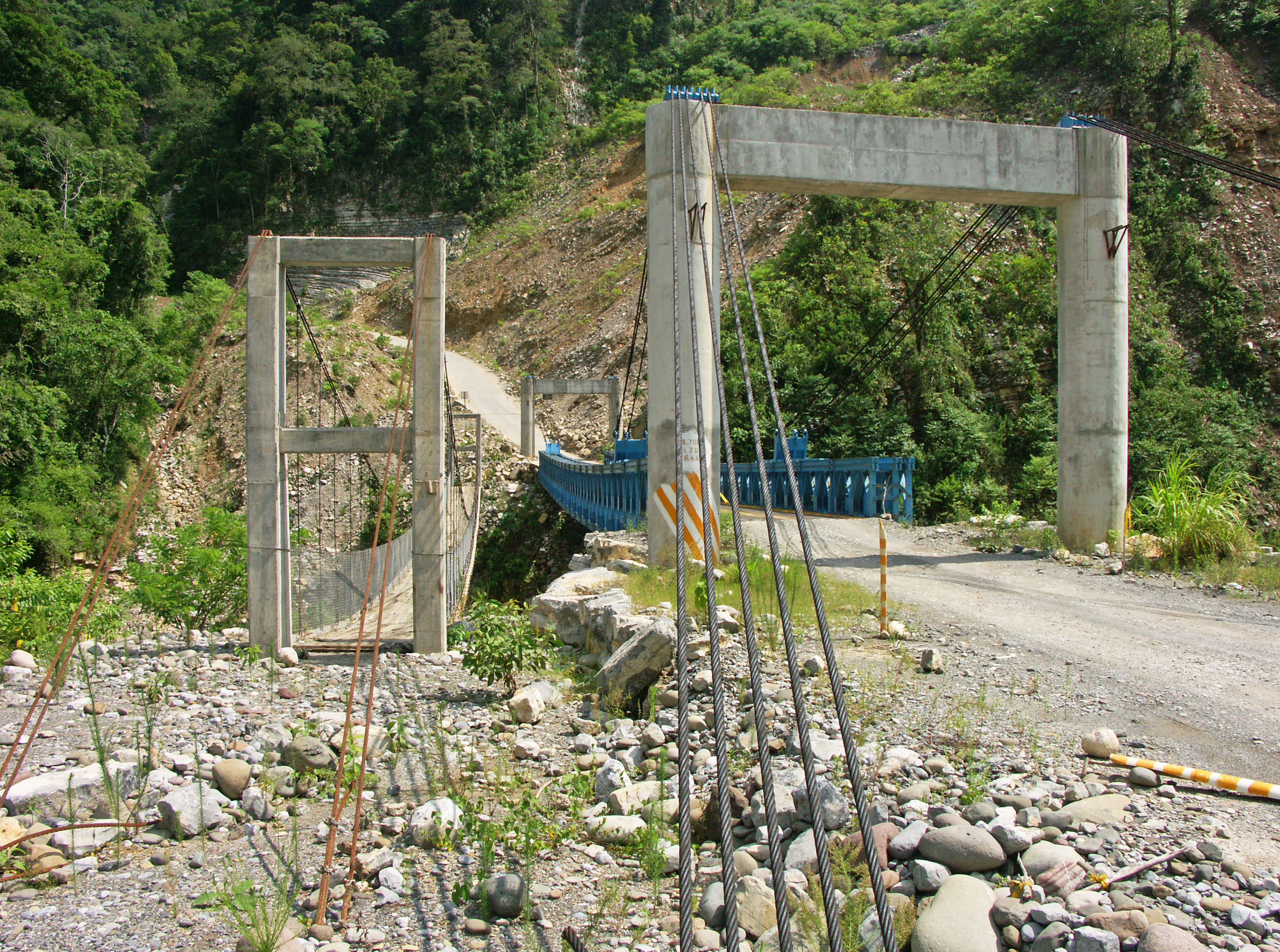
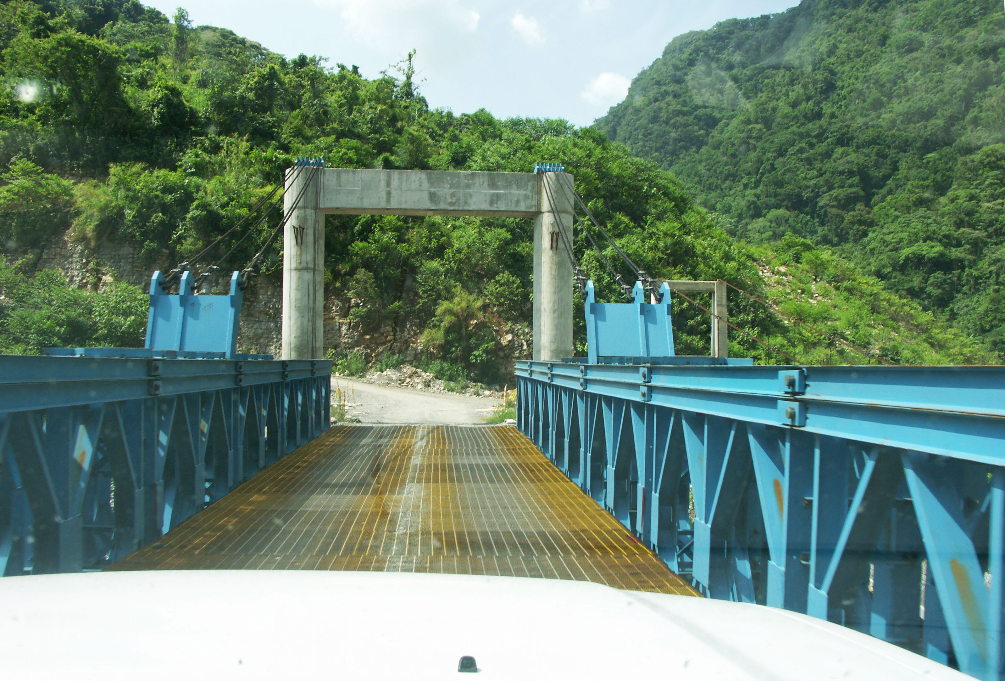
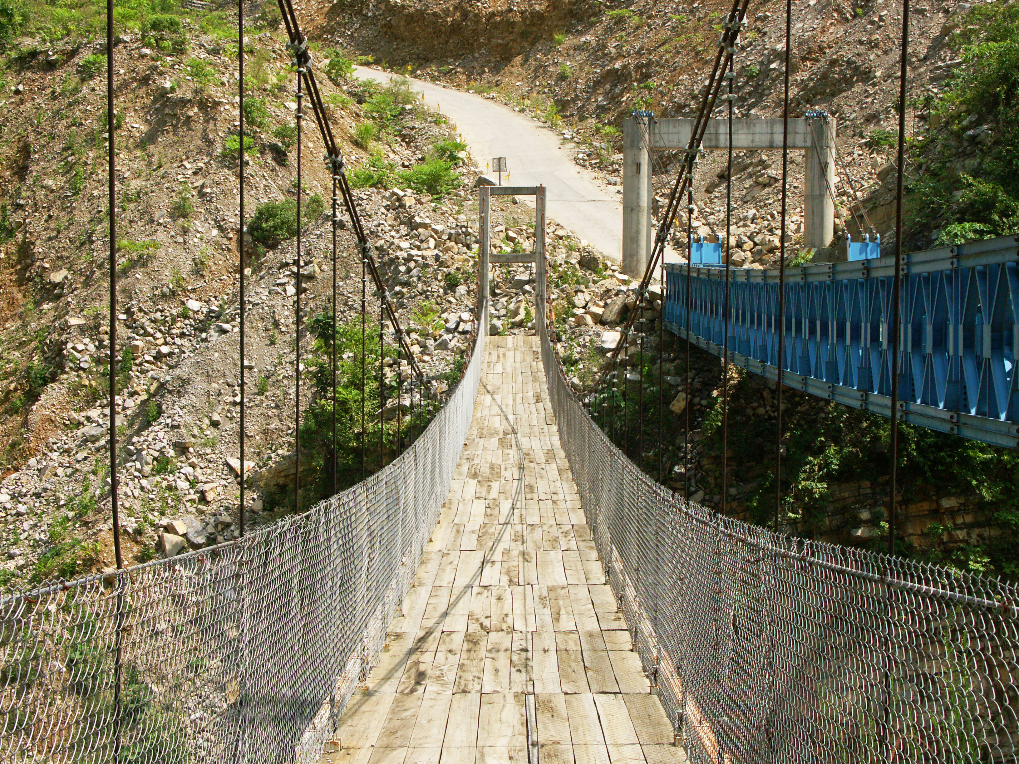
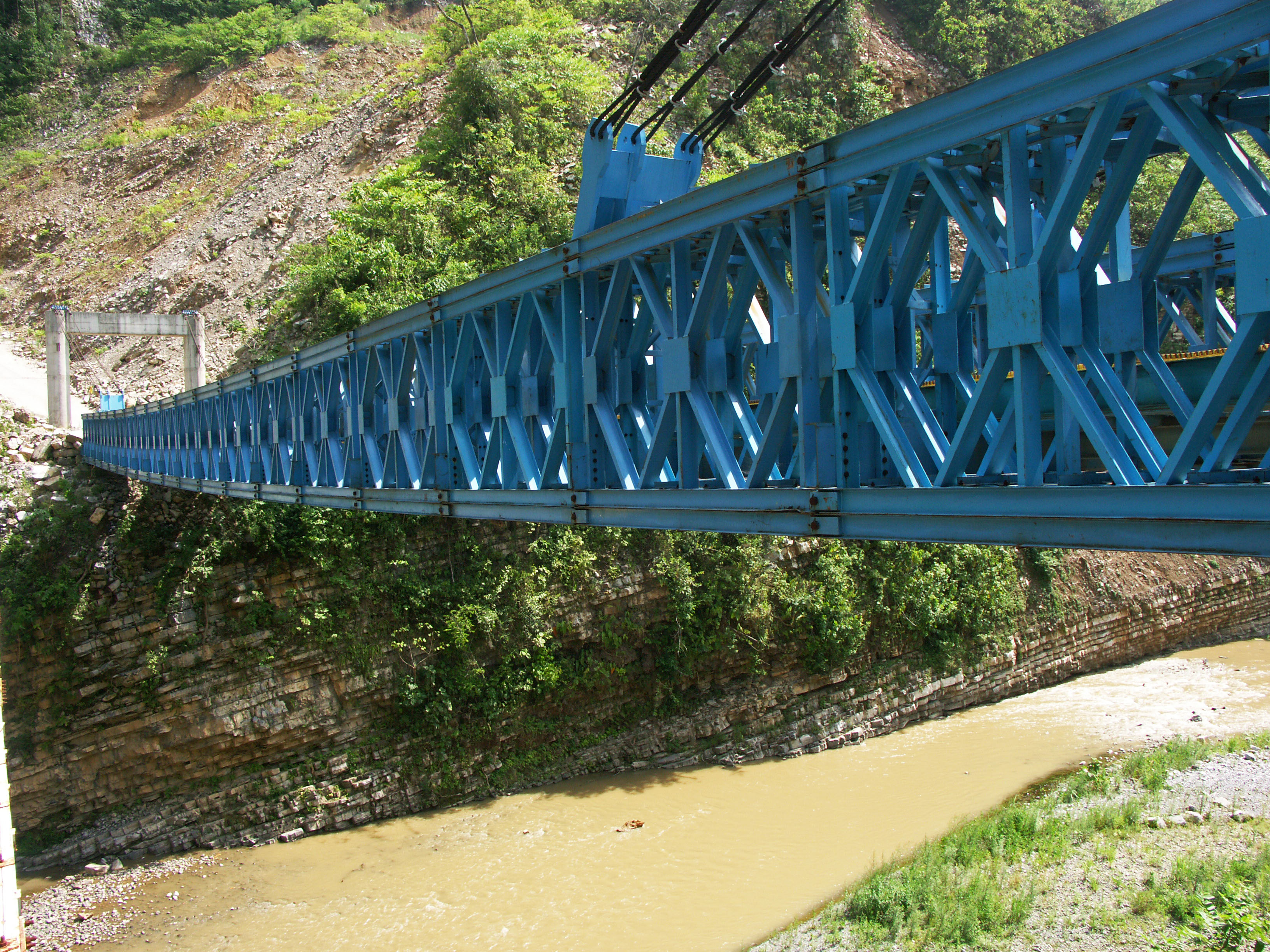
| + | A Bailey type truss bridge with a clear span of approximately 60 meters / 200 feet was built to aid in the construction of the giant highway bridge. A parallel suspension footbridge also crosses the San Marcos River. Both bridges have a tower to tower distance of approximately 70 meters / 230 feet. Image by Eric Sakowski / HighestBridges.com | ||
| + | |||
| + | |||
| + | [[File:SanMarcosSuspensionBridges.jpg|750px|center]] | ||
| + | The Bailey truss is assisted by cable stays though it was interesting to see the cables terminate at the top of the south tower. On the north tower the cables terminate into a ground anchorage. Image by Eric Sakowski / HighestBridges.com | ||
| + | |||
| + | |||
| + | [[File:SanMarcosSuspensionCables.jpg|750px|center]] | ||
| + | Image by Eric Sakowski / HighestBridges.com | ||
| + | |||
| + | |||
| + | [[File:SanMarcosSuspensionDeck2.jpg|750px|center]] | ||
| + | Image by Eric Sakowski / HighestBridges.com | ||
| + | |||
| + | |||
| + | [[File:SanMarcosSuspensionFootbridge.jpg|750px|center]] | ||
| + | Image by Eric Sakowski / HighestBridges.com | ||
| + | |||
| + | |||
| + | [[File:SanMarcosSuspensionTruss.jpg|750px|center]] | ||
| + | Image by Eric Sakowski / HighestBridges.com | ||
| + | |||
| + | |||
| + | [[File:SanMarcosBridges.jpg|750px|center]] | ||
| + | Image by Eric Sakowski / HighestBridges.com | ||
| + | |||
| + | |||
| + | [[File:SanMarcos&GrupoTriadaTruck.jpg|750px|center]] | ||
| + | Image by Eric Sakowski / HighestBridges.com | ||
| + | |||
| + | |||
| + | [[File:SanMarcosLongSuspensionFootbridge.jpg|750px|center]] | ||
| + | Another long footbridge across the San Marcos River about 1 kilometer downstream of the highway crossing. With a main span of at least 110 meters / 360 feet, this would rank among the 25 longest footbridges in North America. Image by Eric Sakowski / HighestBridges.com | ||
| + | |||
| + | |||
| + | [[File:SanMarcosFar&Wide.jpg|750px|center]] | ||
| + | Image by Eric Sakowski / HighestBridges.com | ||
| + | |||
| + | |||
| + | [[File:LaArdilla&SanMarcos.jpg|750px|center]] | ||
| + | Image by Eric Sakowski / HighestBridges.com | ||
| + | |||
| + | |||
| + | [[File:SanMarcosSatellite.jpg|750px|center]] | ||
| + | San Marcos Bridge satellite image. | ||
| + | |||
| + | |||
| + | [[File:SanMarcosSatelliteClose.jpg|750px|center]] | ||
| + | |||
| + | |||
| + | [[File:SanMarcosSatelliteWide.jpg|750px|center]] | ||
| + | |||
| + | [[File:SanMarcosLocationMap.jpg|750px|center]] | ||
| + | San Marcos Bridge location map. | ||
| − | |||
| − | |||
| + | [[File:TexcapaLocationMapWide.jpg|750px|center]] | ||
| − | |||
| + | [[File:TuxpanBridgesMap.jpg|750px|center]] | ||
| + | Map of Tuxpan highway bridges between kilometers 839 - 873. | ||
| − | |||
| − | |||
| + | [[File:TuxpanTunnelMap.jpg|750px|center]] | ||
| + | Map of Tuxpan highway tunnels between kilometers 839 - 873. | ||
| − | |||
| + | [[File:SanMarcosHighwayMap.jpg|630px|center]] | ||
| + | A map of the most difficult stretch of highway between Nuevo Necaxa and Ávila Camacho. | ||
| − | |||
| + | [[File:SanMarcosHighwayMap2.jpg|750px|center]] | ||
| + | When completed, the México-Tuxpan highway will connect Mexico City with the Gulf of Mexico 182 miles (293 kms) away. | ||
| − | |||
| + | [[File:SanMarcosCarreteraMap.jpg|630px|center]] | ||
| + | The new carretera will open up new trade routes to the interior of the country as well as Mexico City. | ||
| − | |||
| − | |||
| + | [[File:SanMarcosTopoAccess.jpg|550px|center]] | ||
| + | San Marcos Bridge access roads topographic map. | ||
[[Category:Bridges in Mexico]] | [[Category:Bridges in Mexico]] | ||
| − | [[Category:Bridges in | + | [[Category:Bridges in Puebla, Mexico]] |
| − | |||
| − | |||
| − | |||
Latest revision as of 21:11, 21 February 2022
San Marcos Bridge
Puente San Marcos
Xicotepec de Juárez, Puebla, Mexico
722 feet high / 220 meters high
591 foot span / 180 meter span
2013
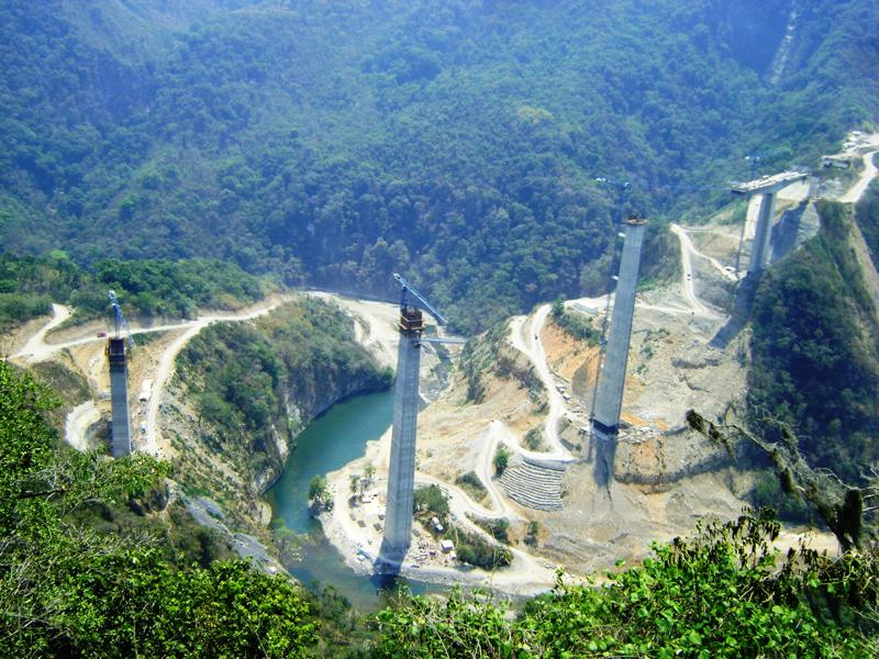
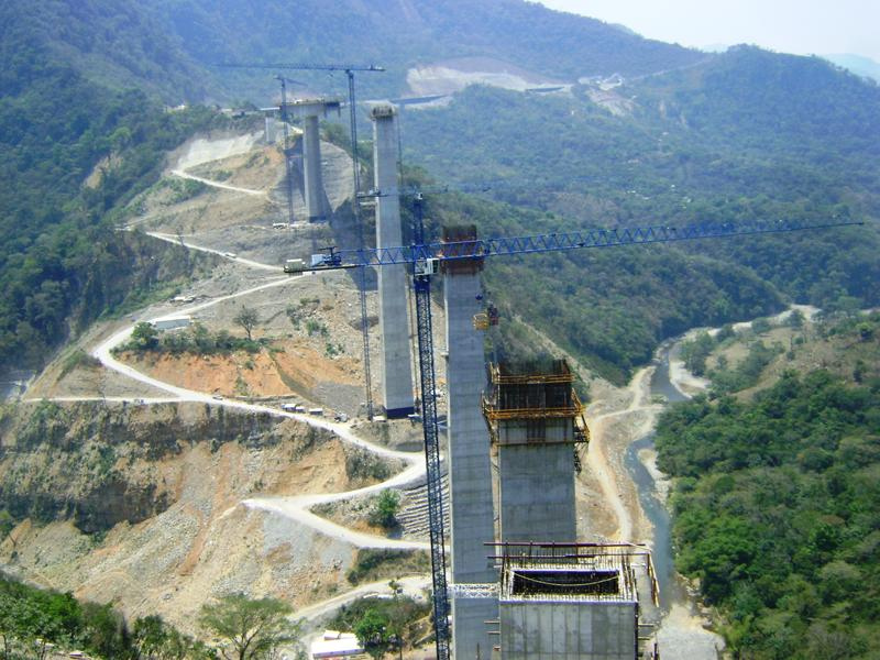
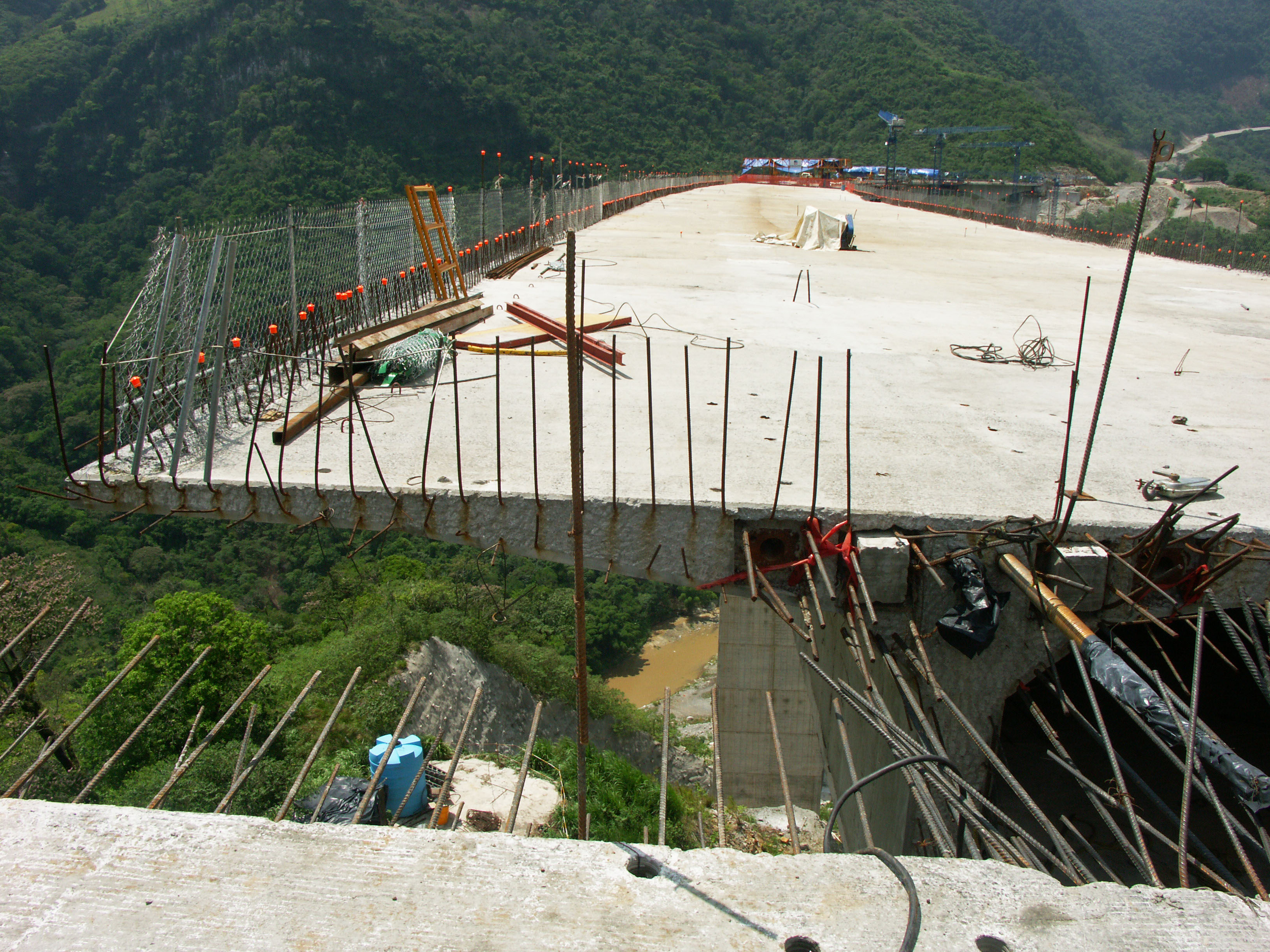
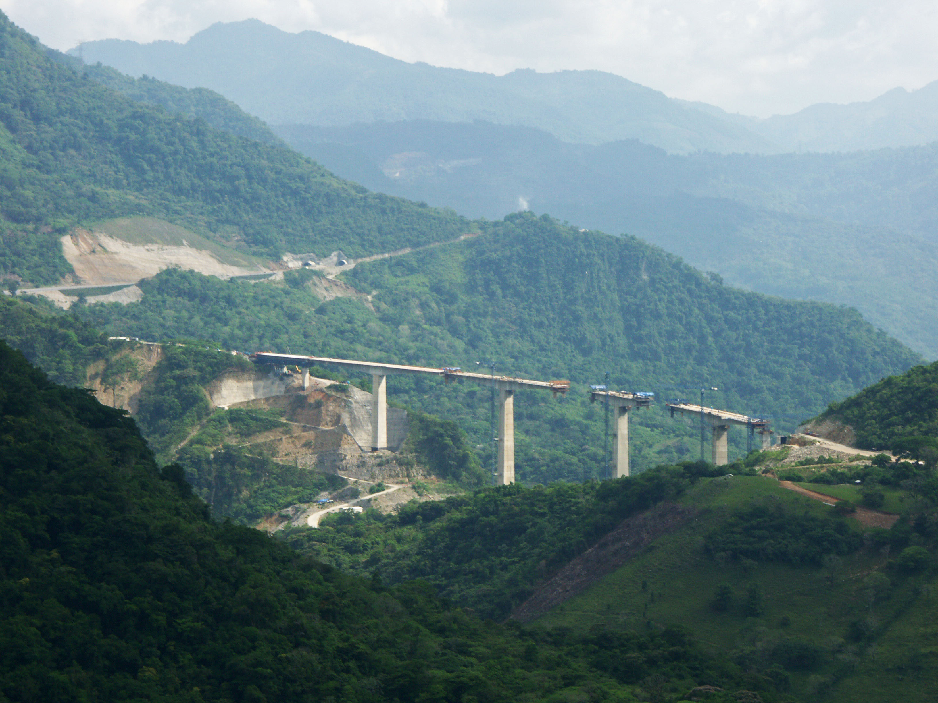
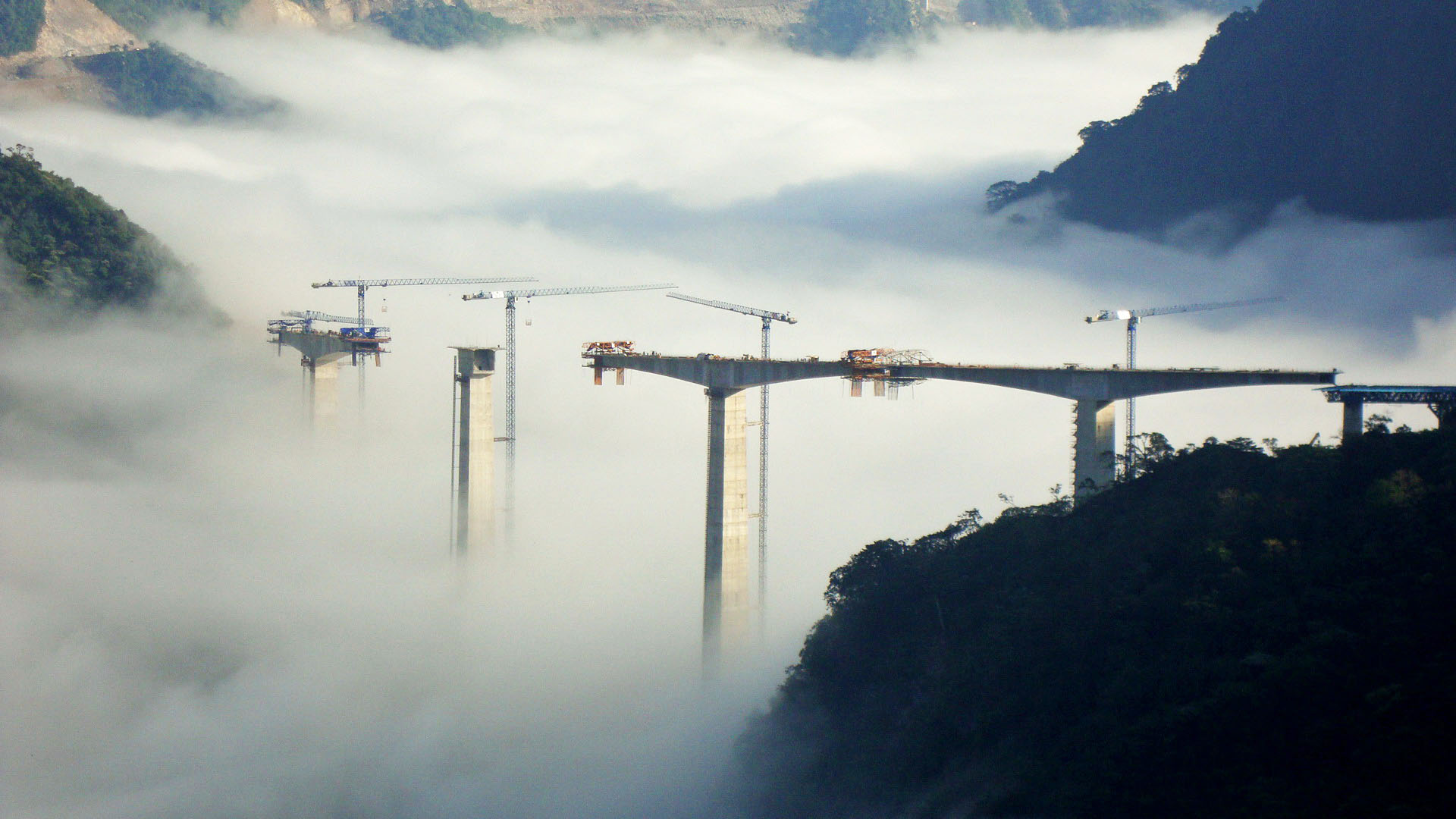
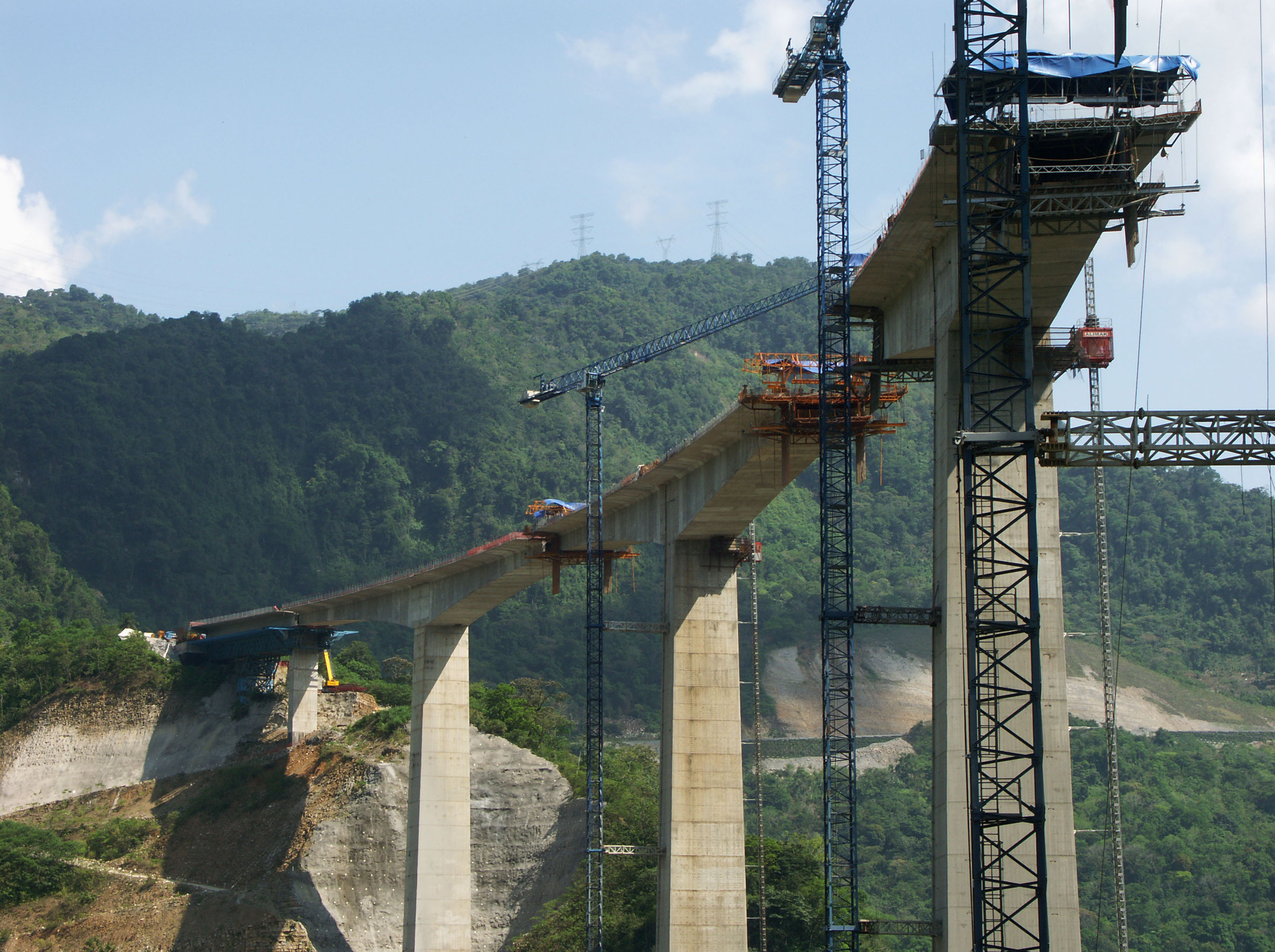
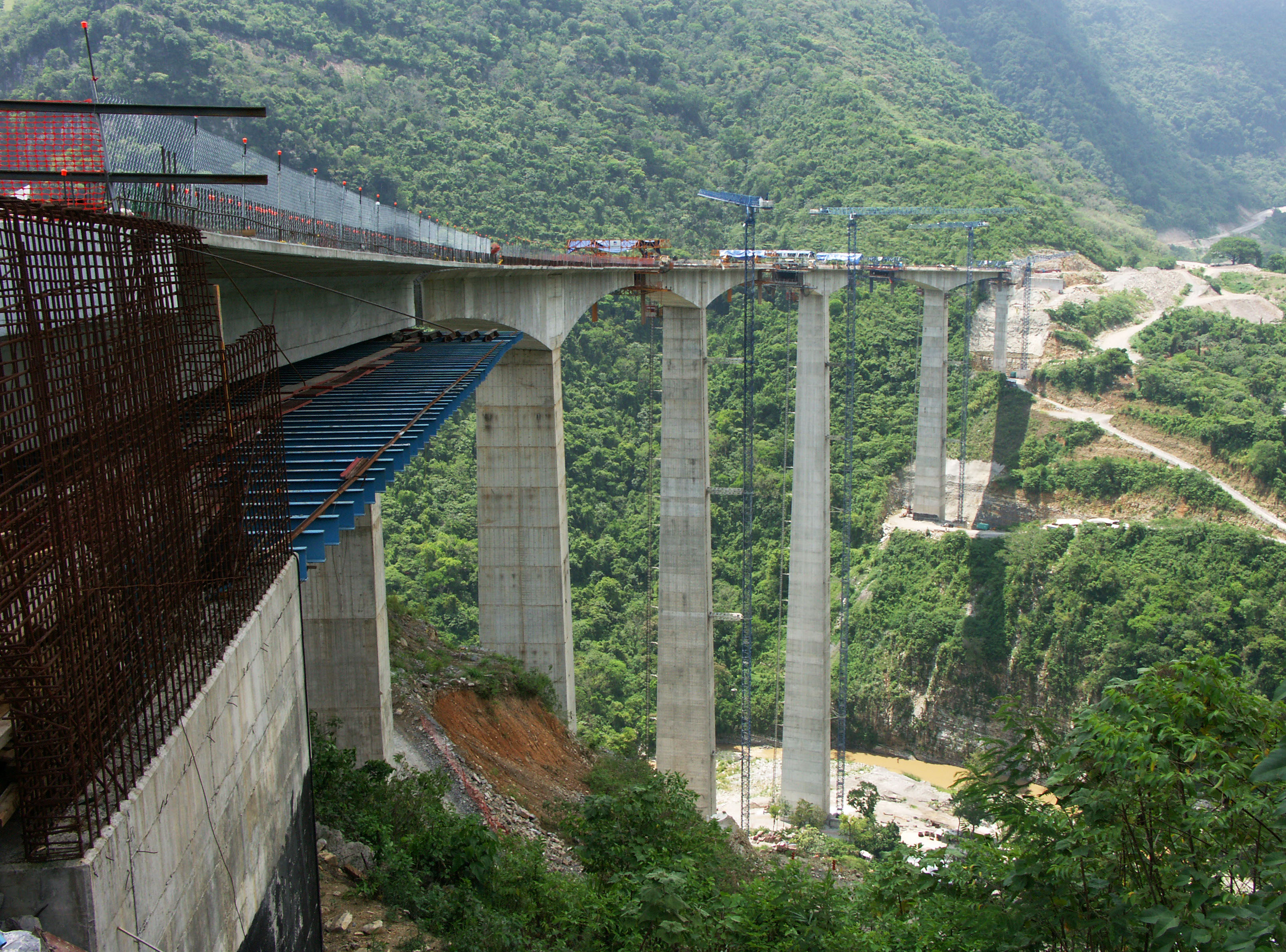
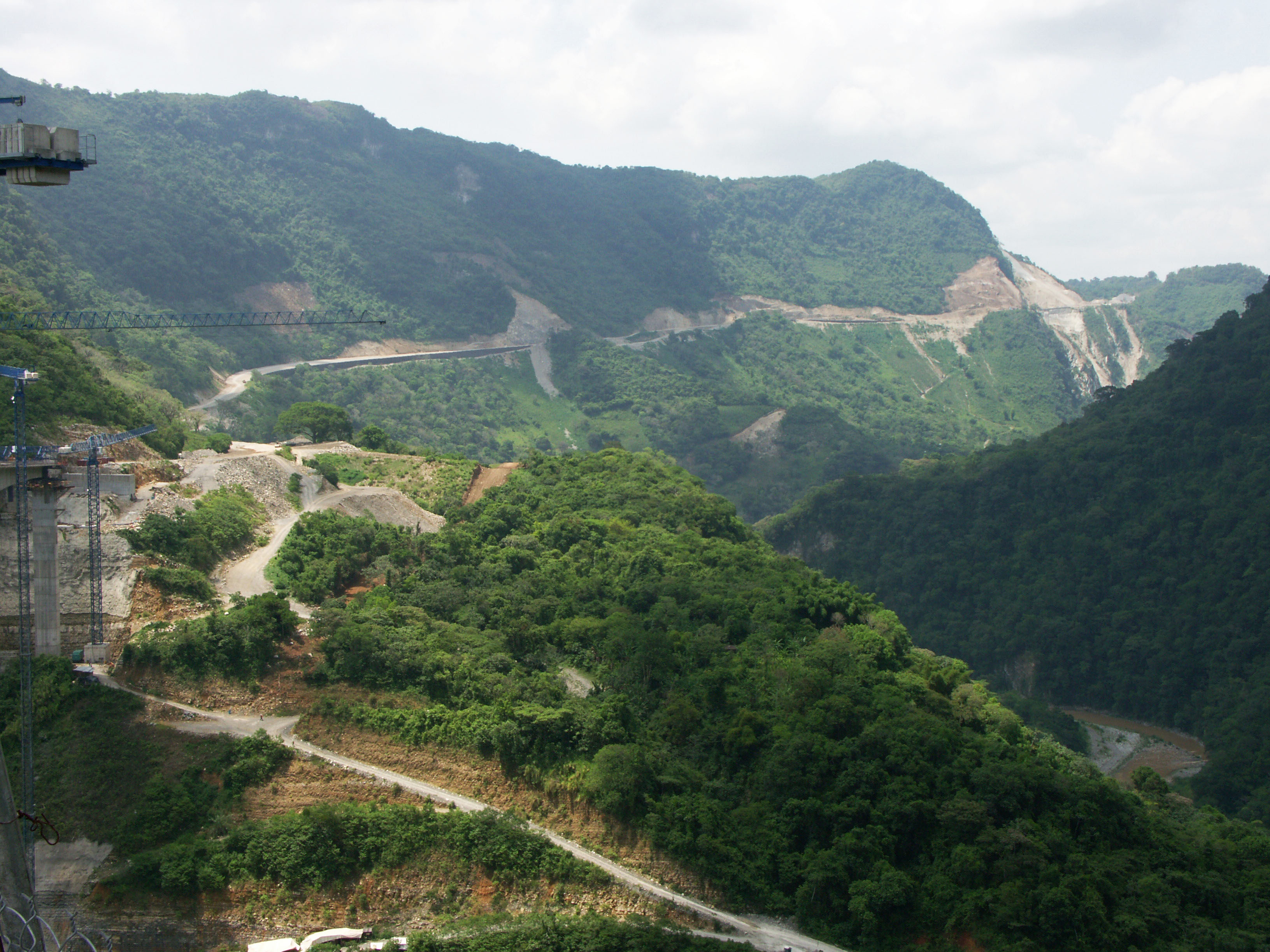
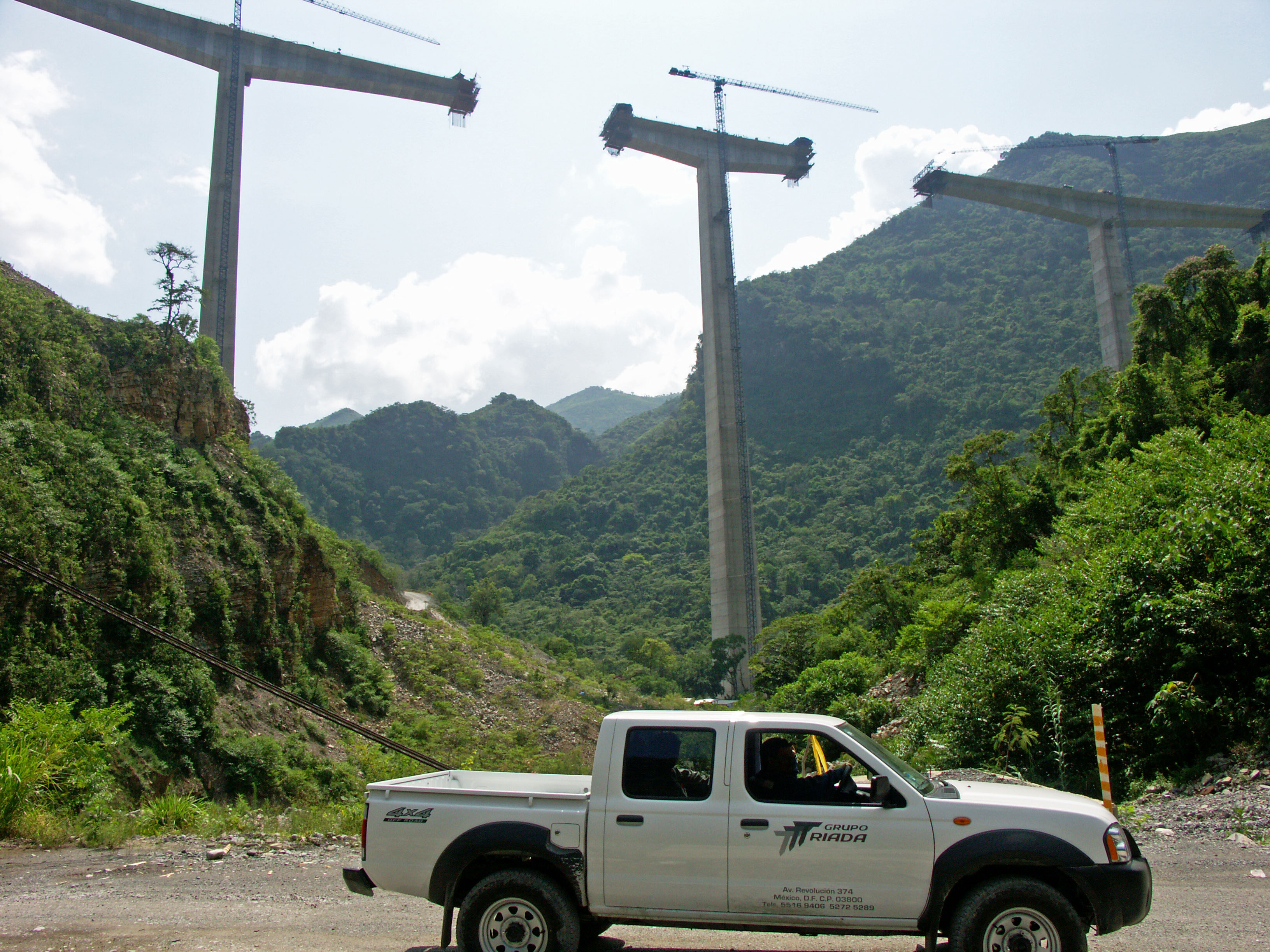
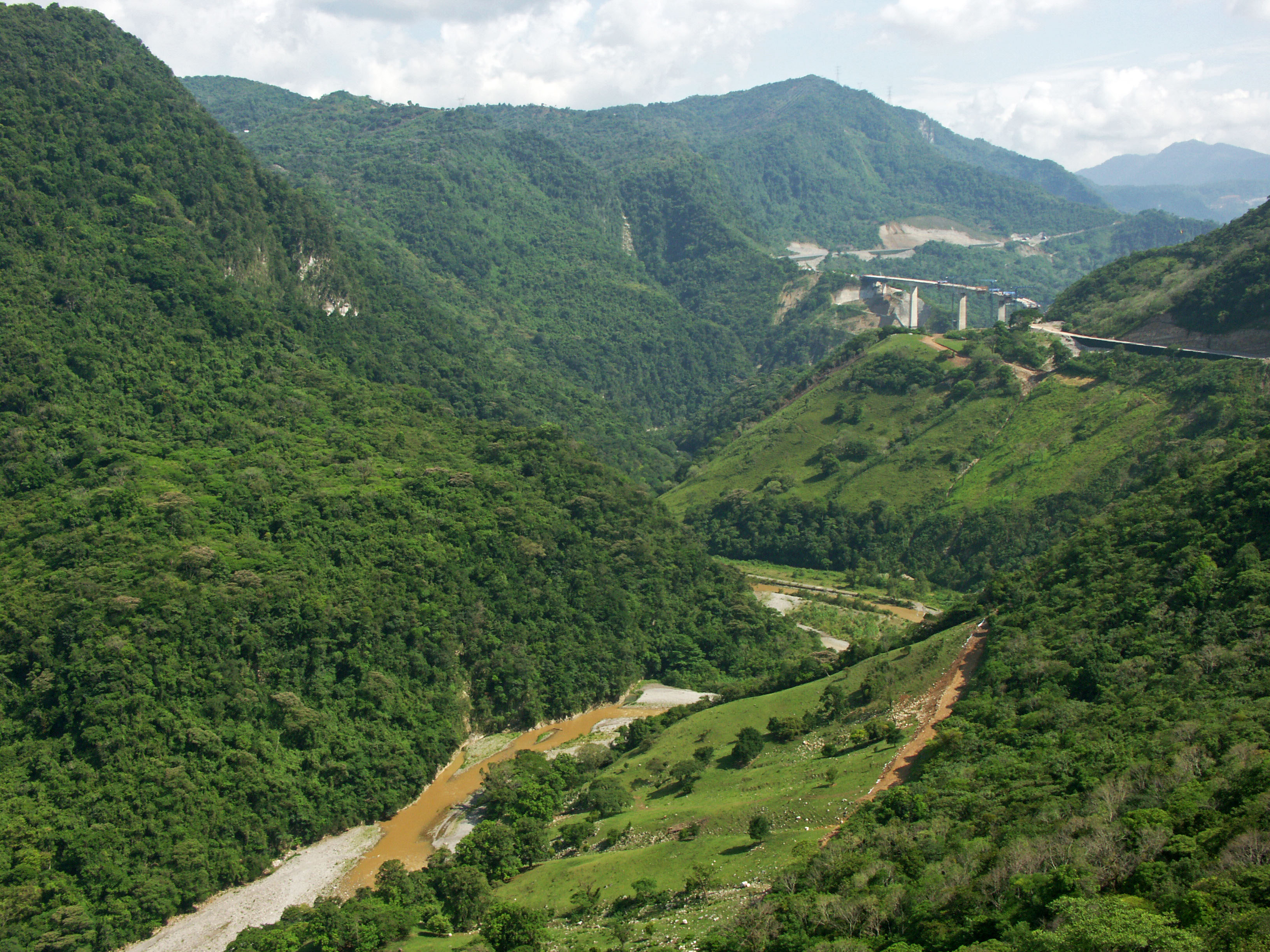
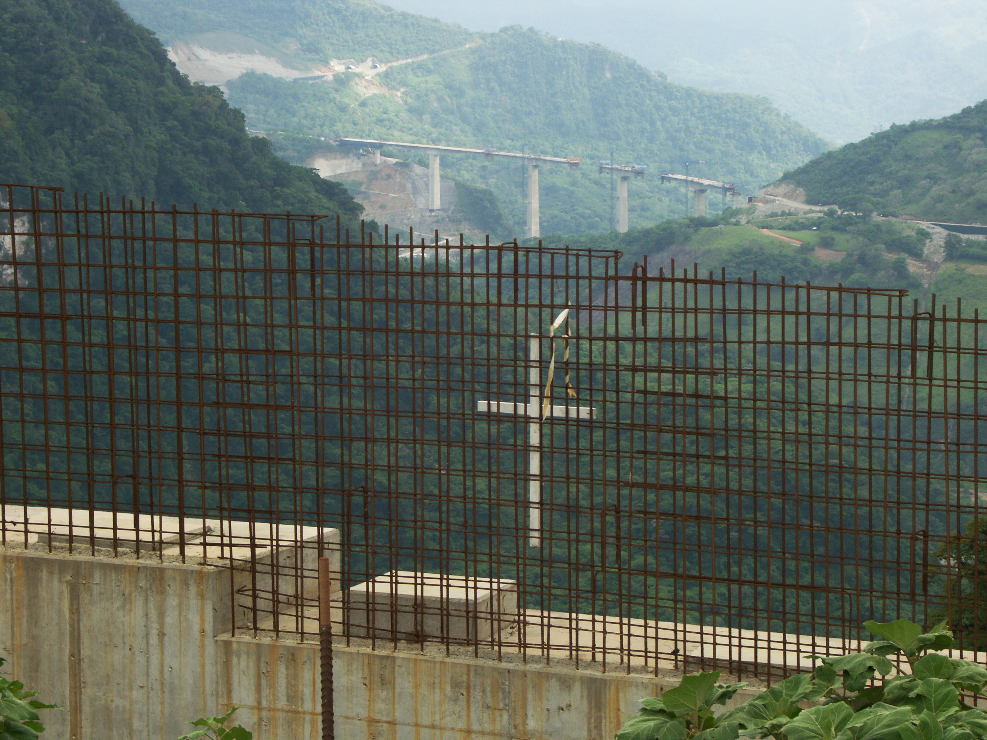
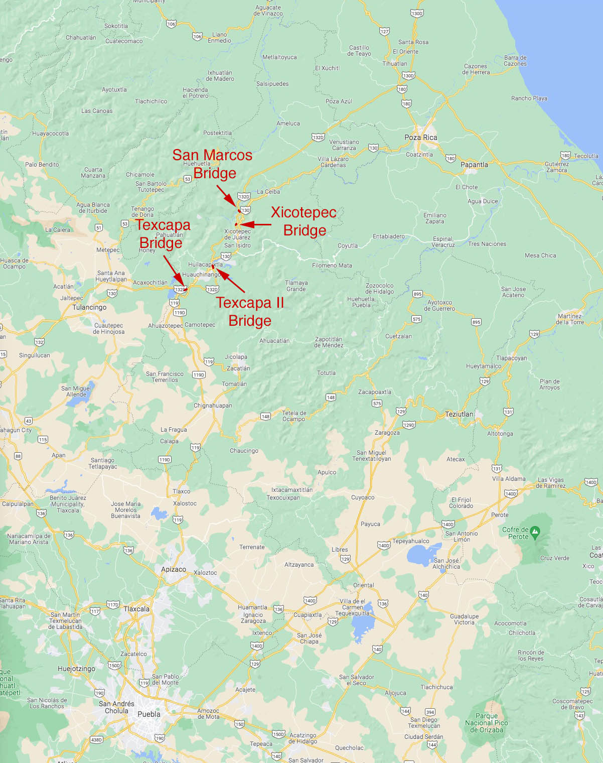
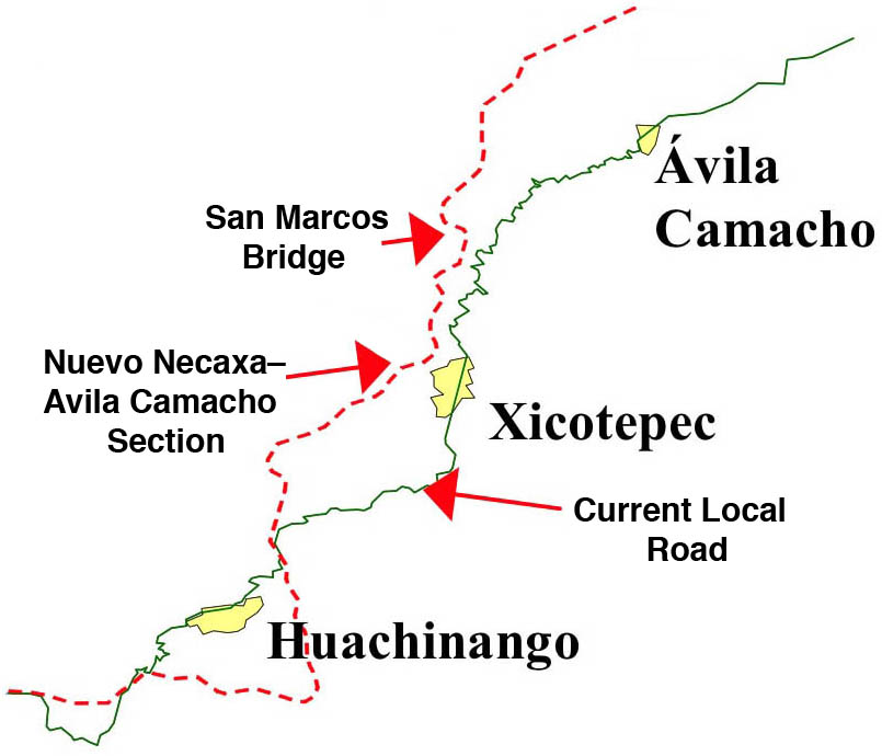
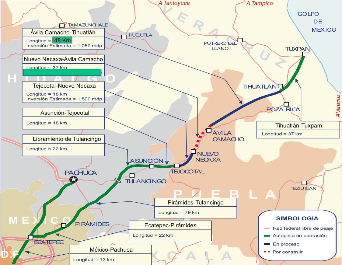
Completed in 2013, the soaring San Marcos bridge is the largest and tallest bridge on the final Nuevo Necaxa-Tihuatlán section of the México-Tuxpan highway now under construction. Extending from Mexico City to the Gulf of Mexico, the first and last thirds of the 182 mile (293 km) highway were finished in 2005. The difficulty in completing the highway lied in the central Nuevo Necaxa–Ávila Camacho section that runs for 23 miles (37 kms) along the mountainous San Marcos River gorge. To push the modern carretera through the steep terrain, the engineers had to construct 6 tunnels and several high bridges. Three of these spans exceed 100 meters in height including Xicotepec, San Marcos and Texcapa Bridge, which was completed in 2005.
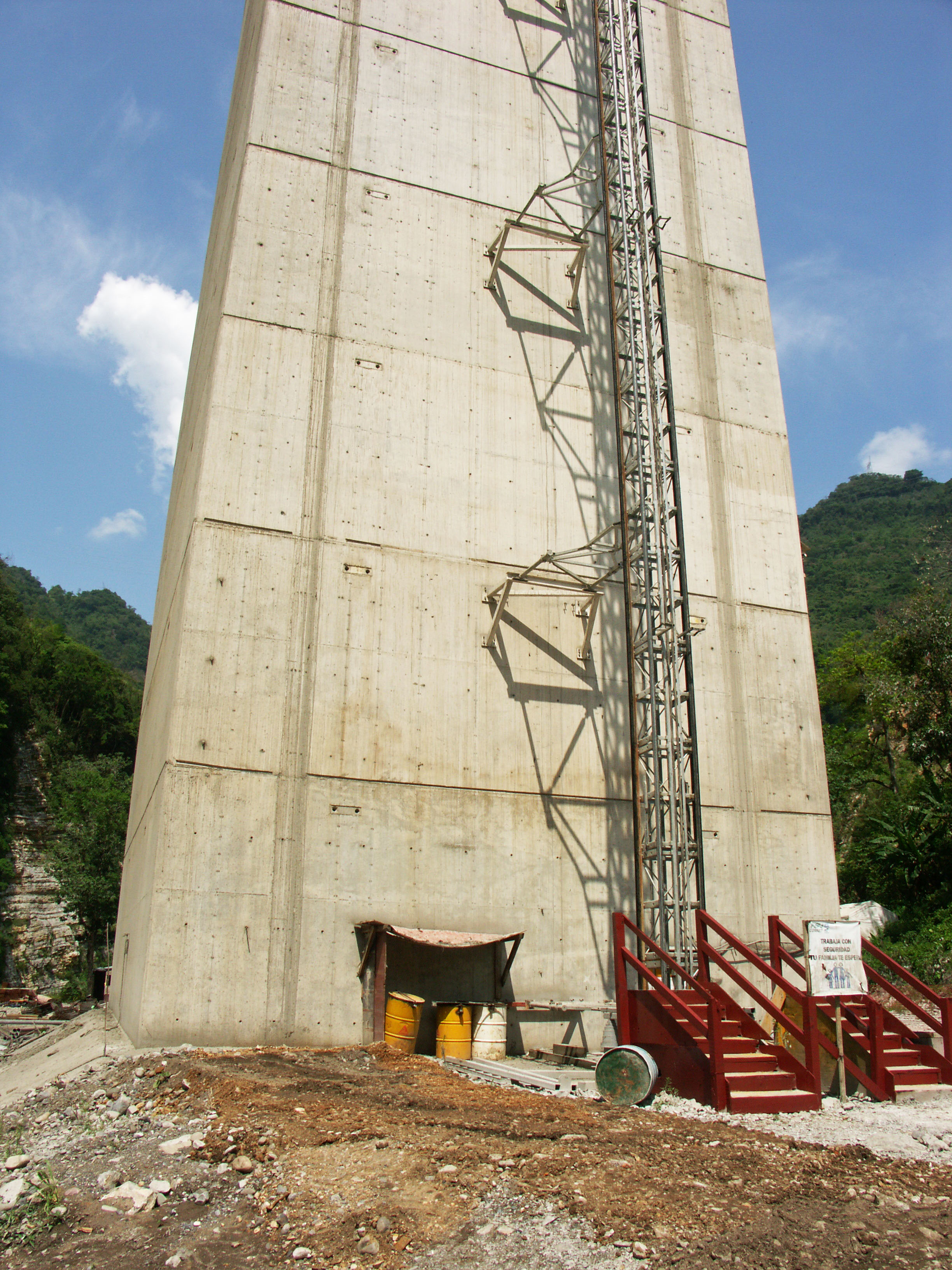
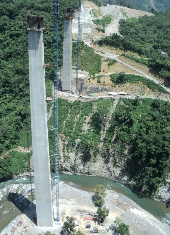
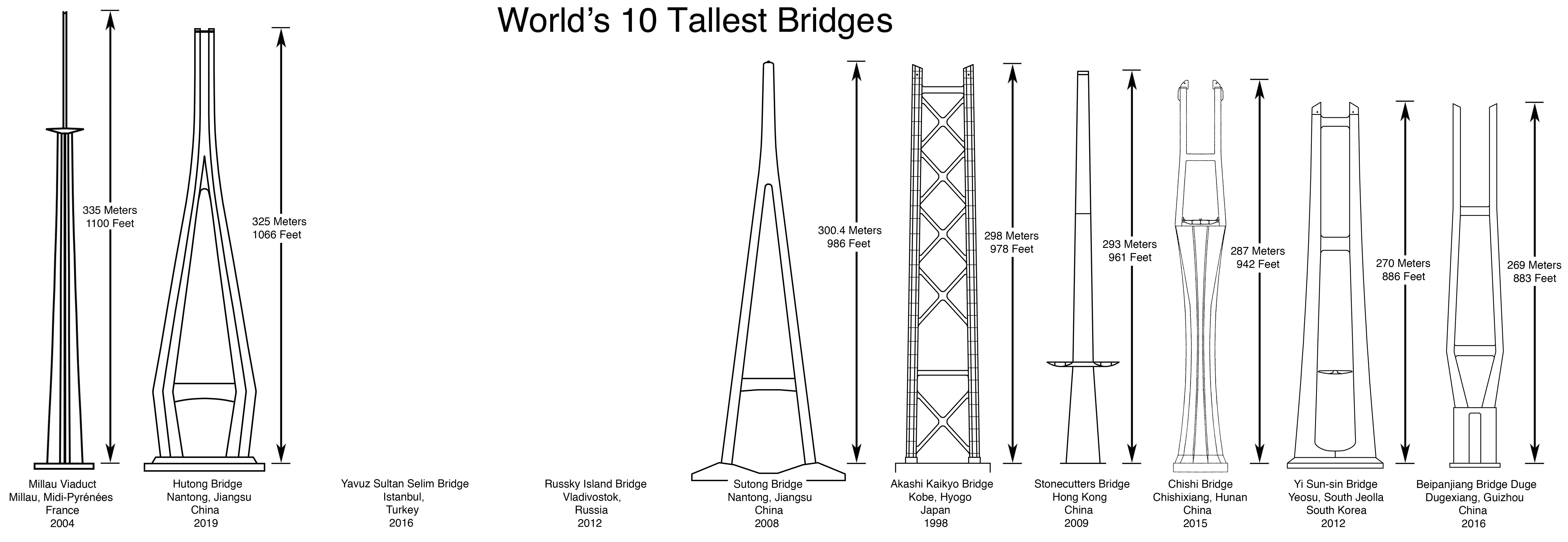
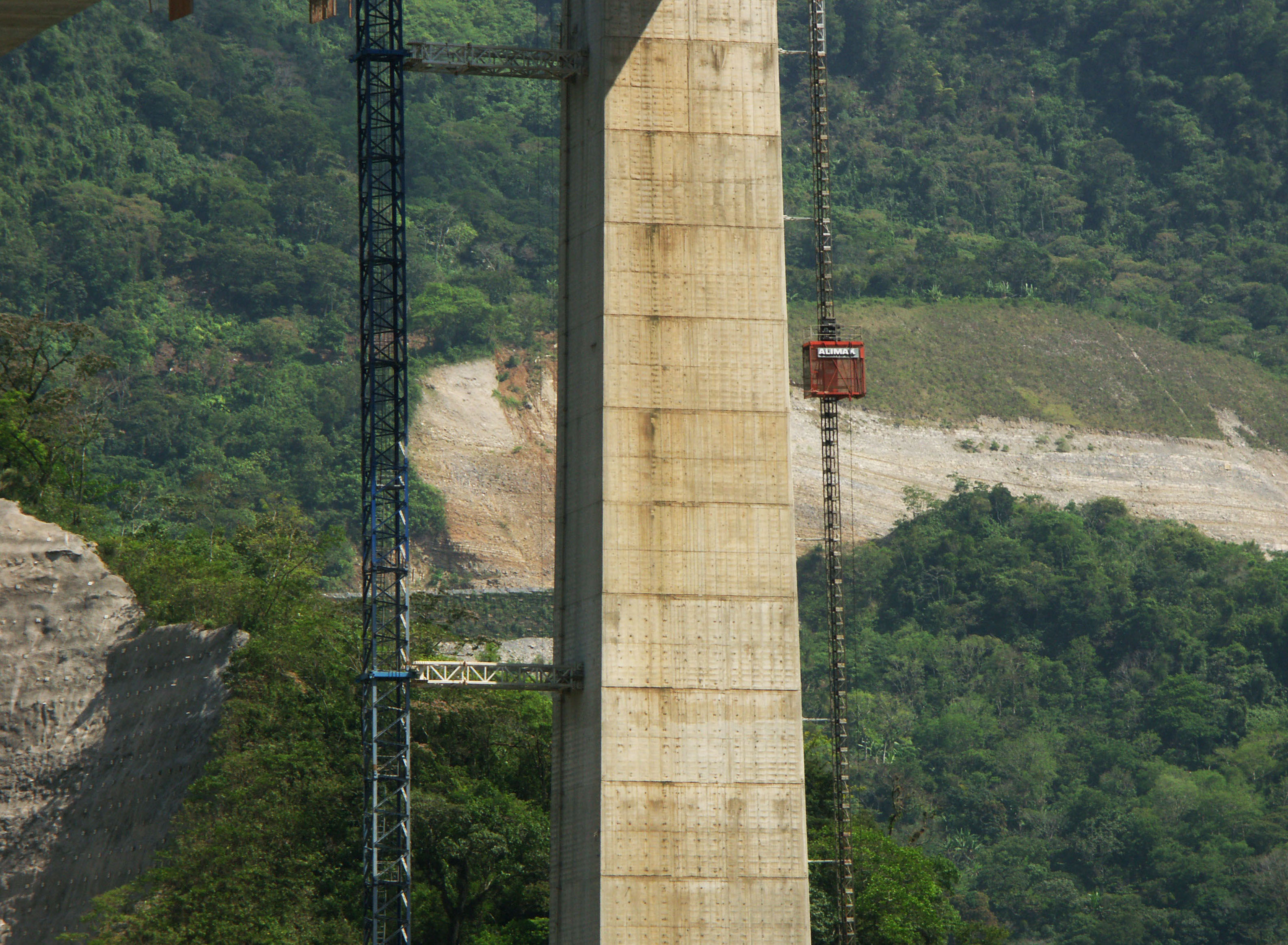
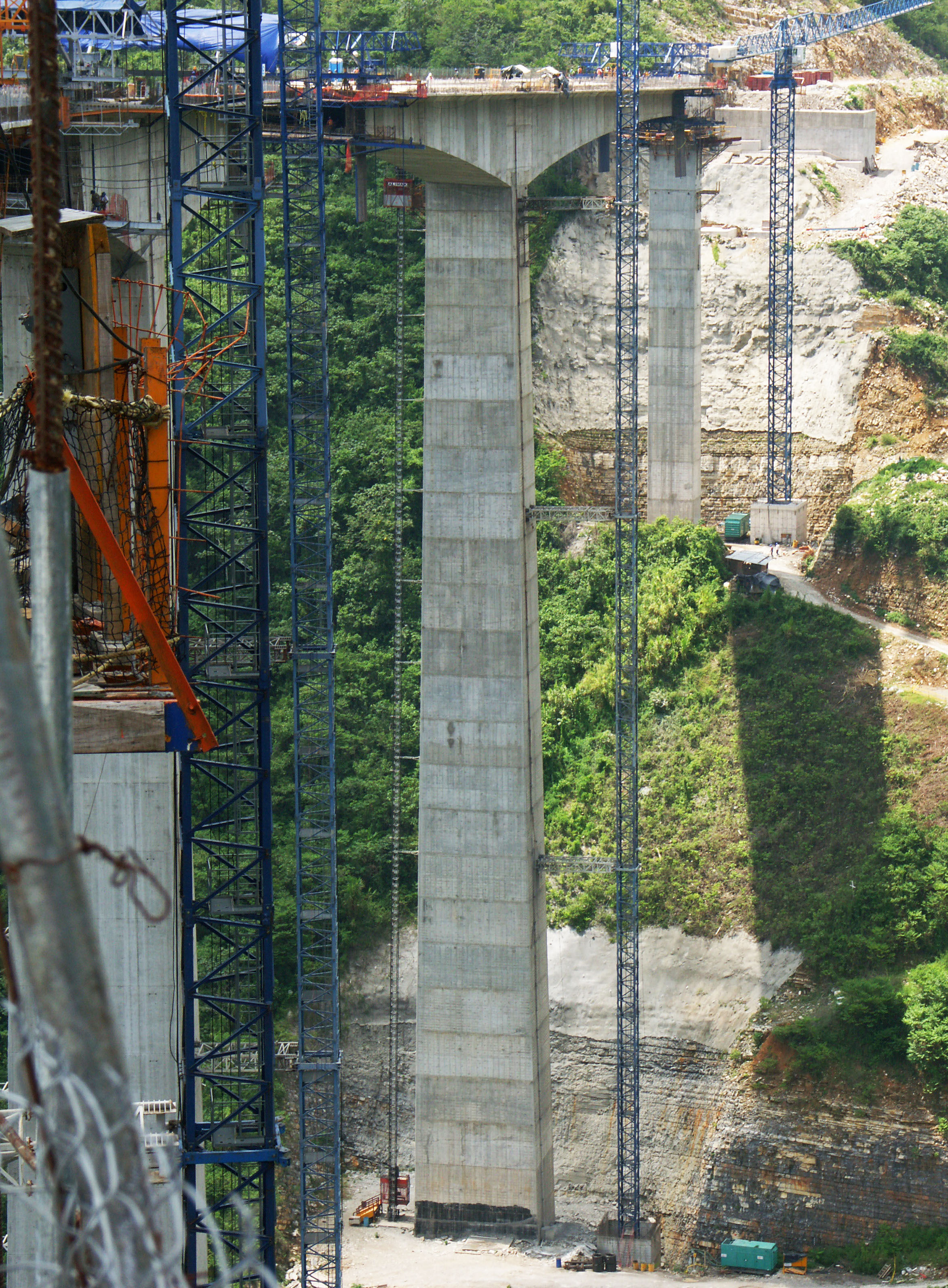
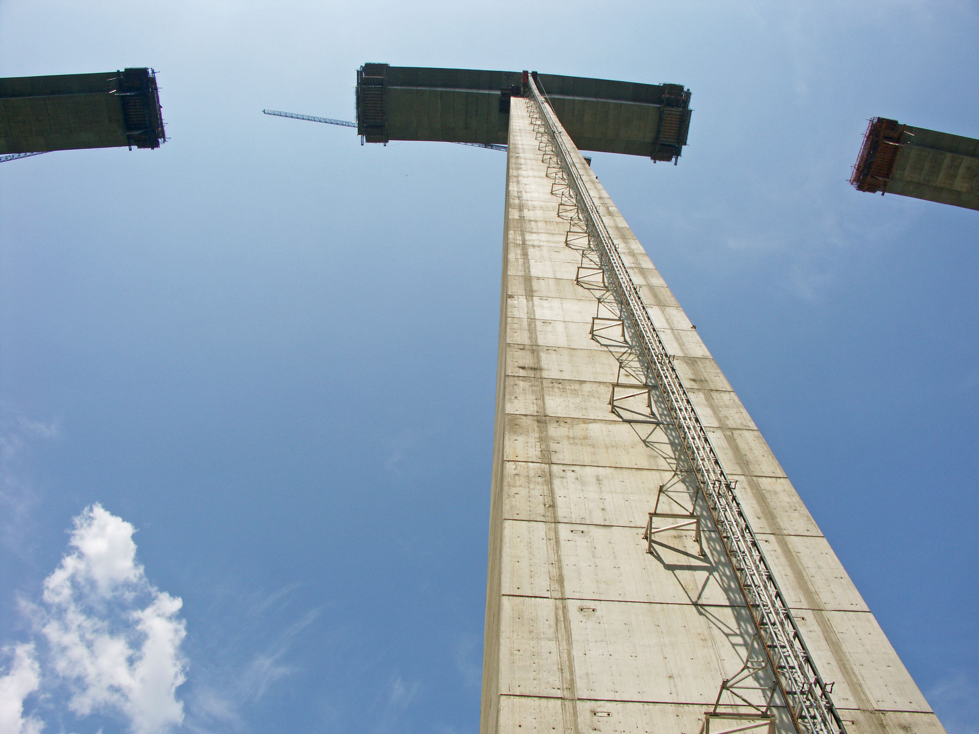
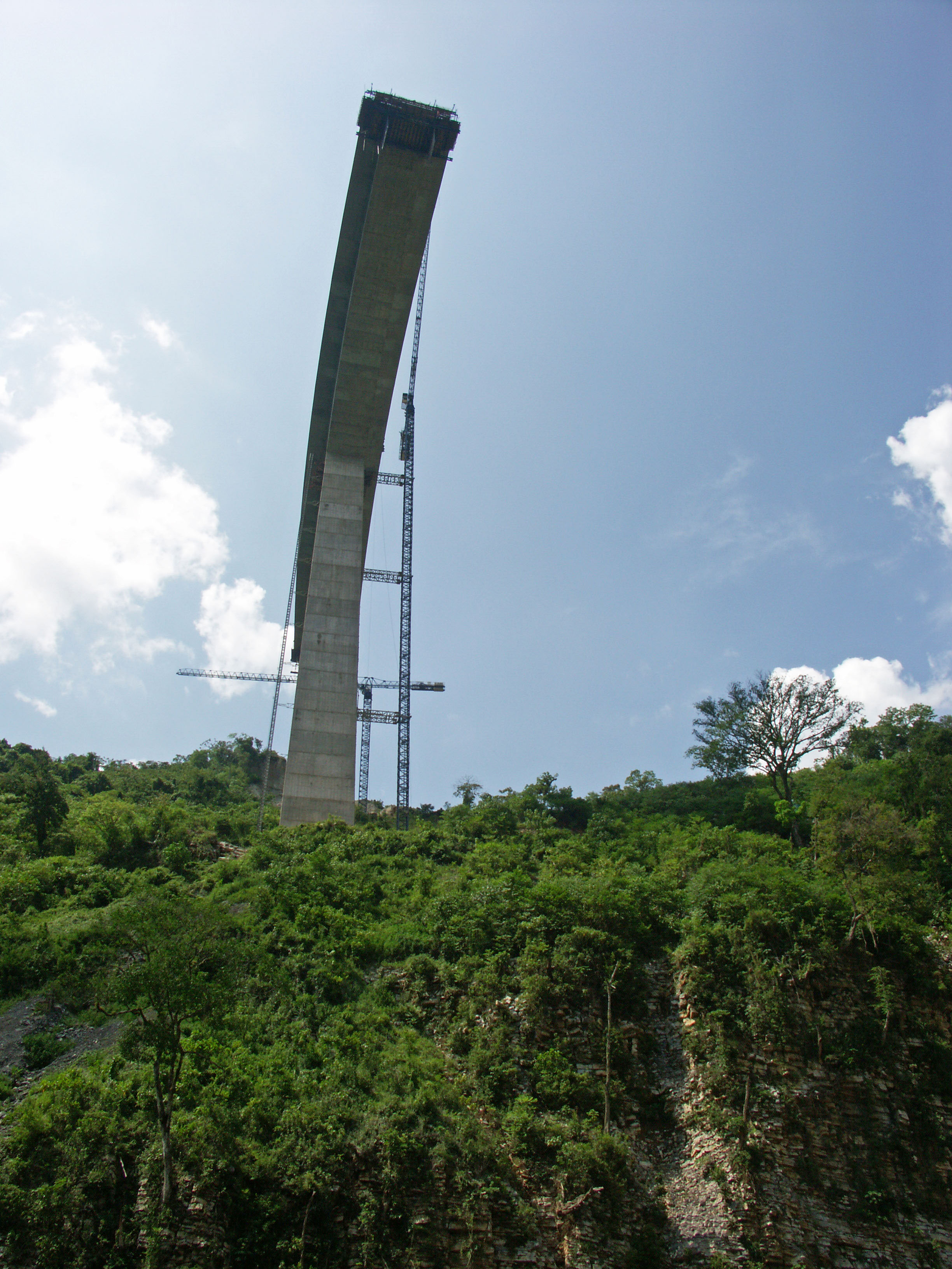
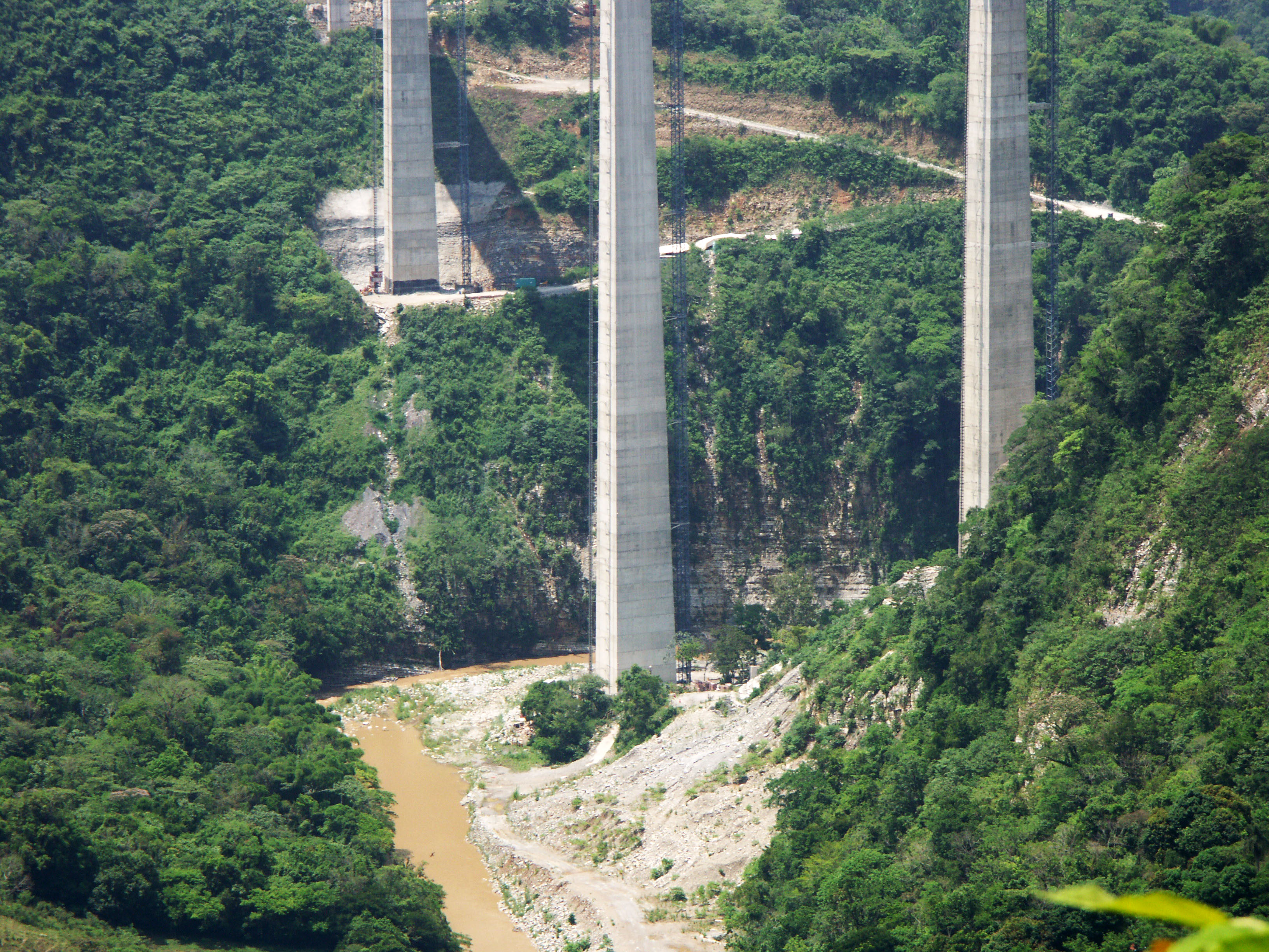
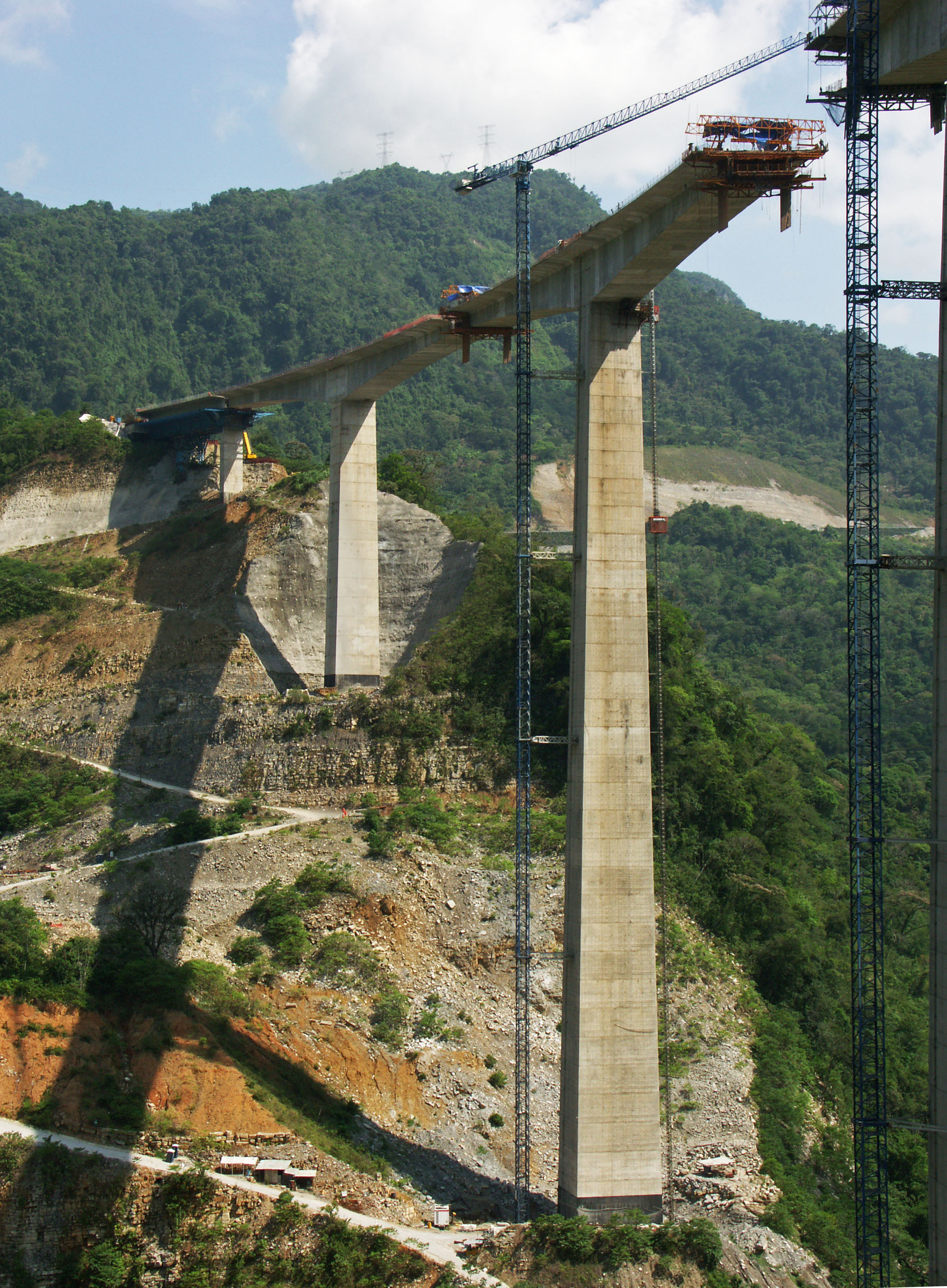
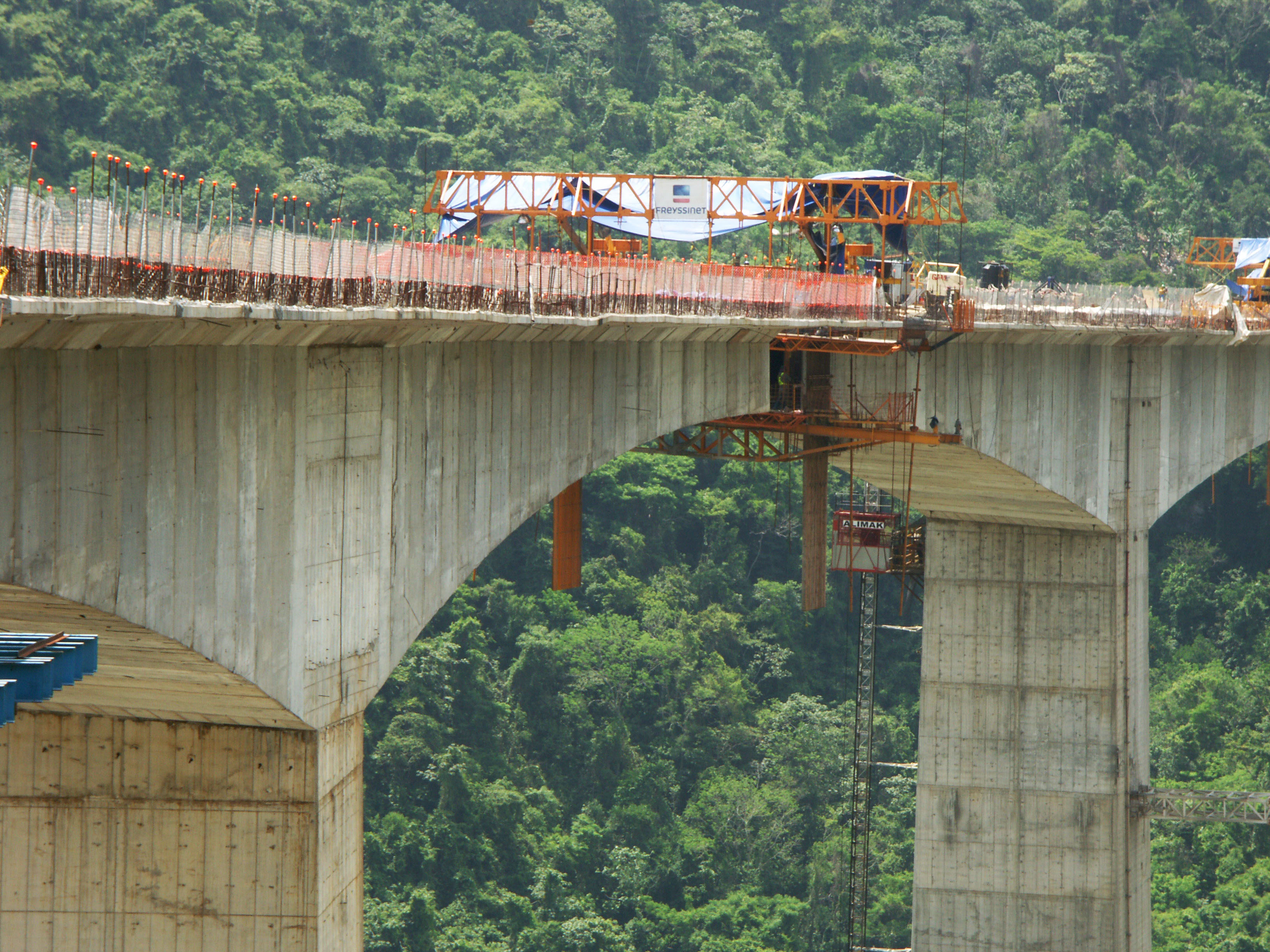
Curving 722 feet (220 meters) above the San Marcos River, the giant prestressed concrete beam viaduct has the second highest bridge pier in the world after the Millau Viaduct in France. Rising 682 feet (208 meters) from the top of the foundation to the underside of the beam, pier number 4 is 100 feet (30 meters) higher than those on either the Longtanhe, Akaishi or Kochertal viaducts in China and Germany.
Interestingly, the original design for the San Marcos River crossing was for a fin back bridge. A prestressed beam bridge with a highly variable depth of prestressing, the fin back is unique for having the internal cables at their highest as they pass over the piers, enclosed in a wall or “fin” of concrete. The hump-like profile may look similar to a cable stayed or extradosed bridge but the engineering has more in common with a beam bridge. Many consider the lower profile to be more attractive than a conventional prestressed beam bridge. Mexico has two other large fin back bridges including the Texcapa bridge which is also located on the México-Tuxpan highway and the Papagayo bridge located on the México City-Acapulco highway.
The first fin back bridge was built in Nuremberg, Germany for a commuter railway in 1969. In the U.S., the only one is the 1987-built Barton Creek bridge near Austin, Texas with a main span of 340 feet (103.5 mtrs).
Image by Eric Sakowski / HighestBridges.com
Image by Eric Sakowski / HighestBridges.com
Image by SCT.
The Tallest Bridges of Mexico and the Torre Mayor Skyscraper
Diagram by Eric Sakowski / HighestBridges.com
Image by SCT.
Image by SCT.
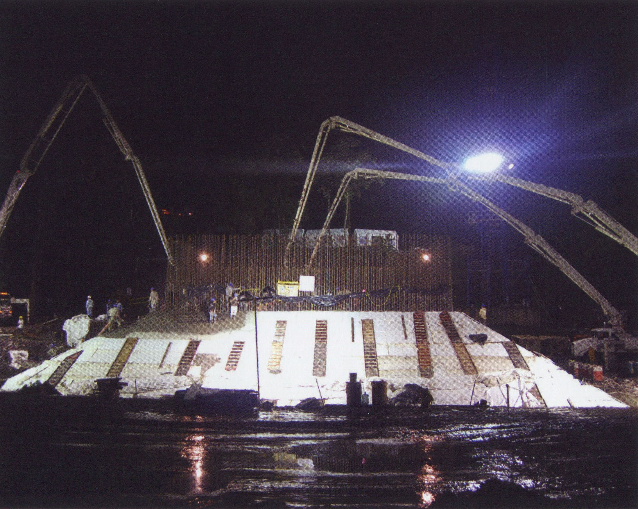
Construction schedule of the world's second tallest pier on the San Marcos Bridge.
Image by Eric Sakowski / HighestBridges.com
Image by Eric Sakowski / HighestBridges.com
Image by Vicente Gayosso.
Image by SCT.
Image by SCT.
Image by SCT.
Image by SCT.
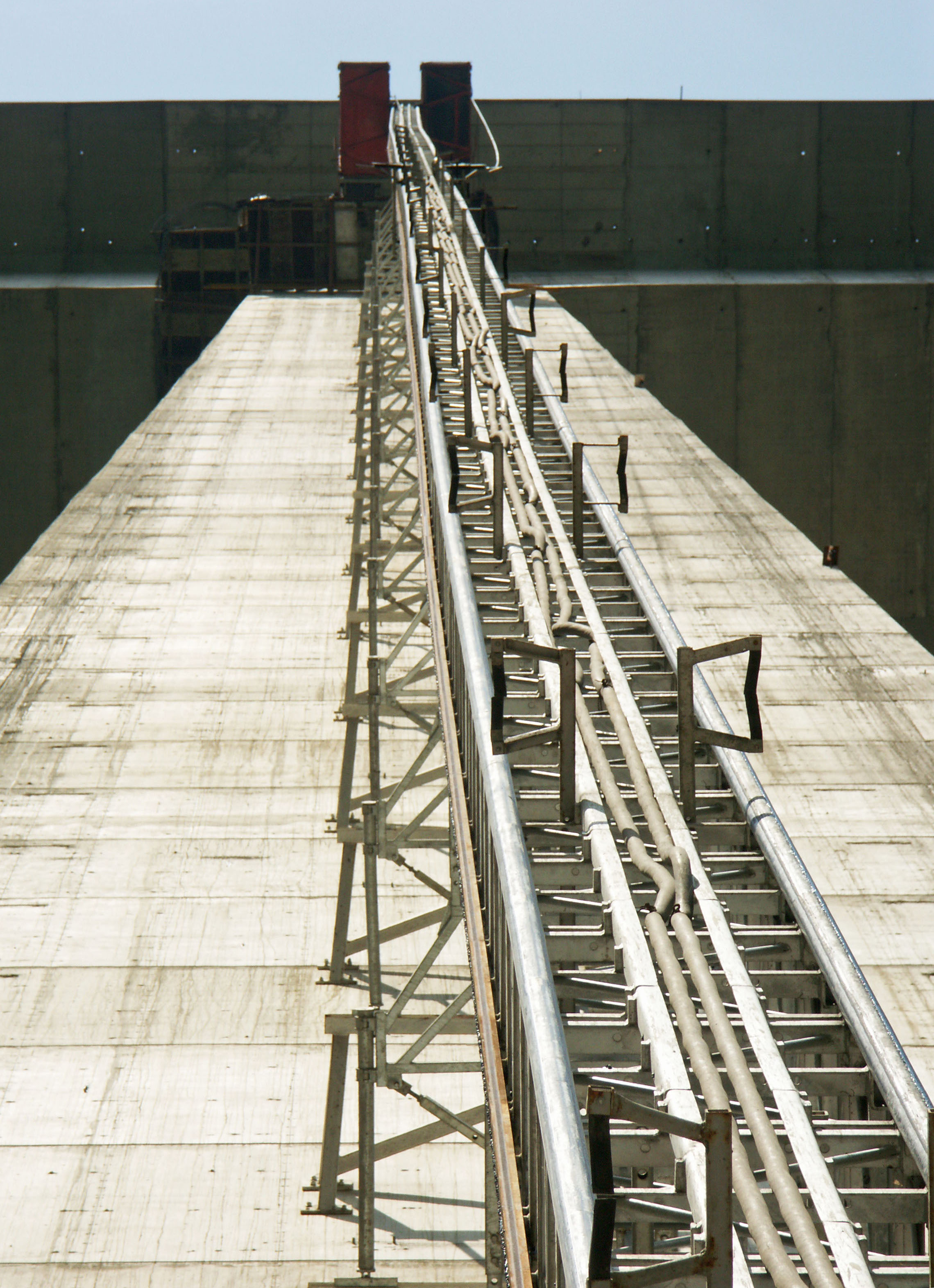
Image by Eric Sakowski / HighestBridges.com
Image by Eric Sakowski / HighestBridges.com
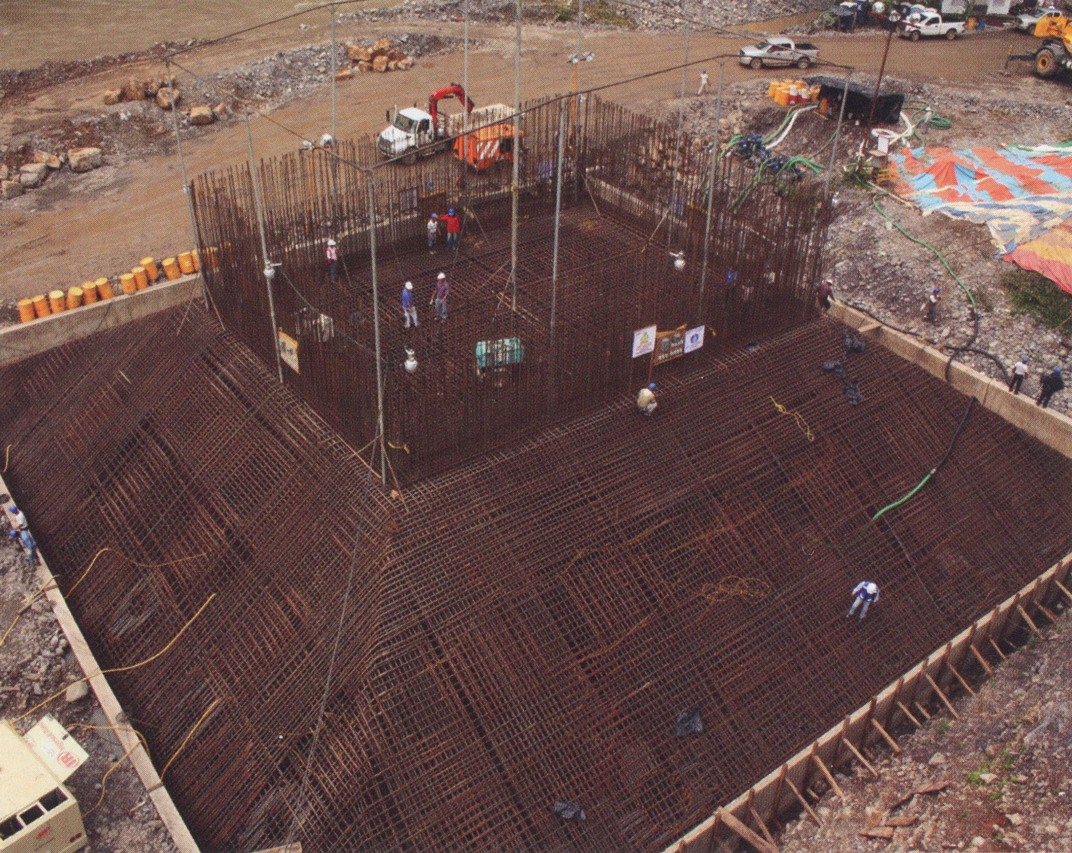
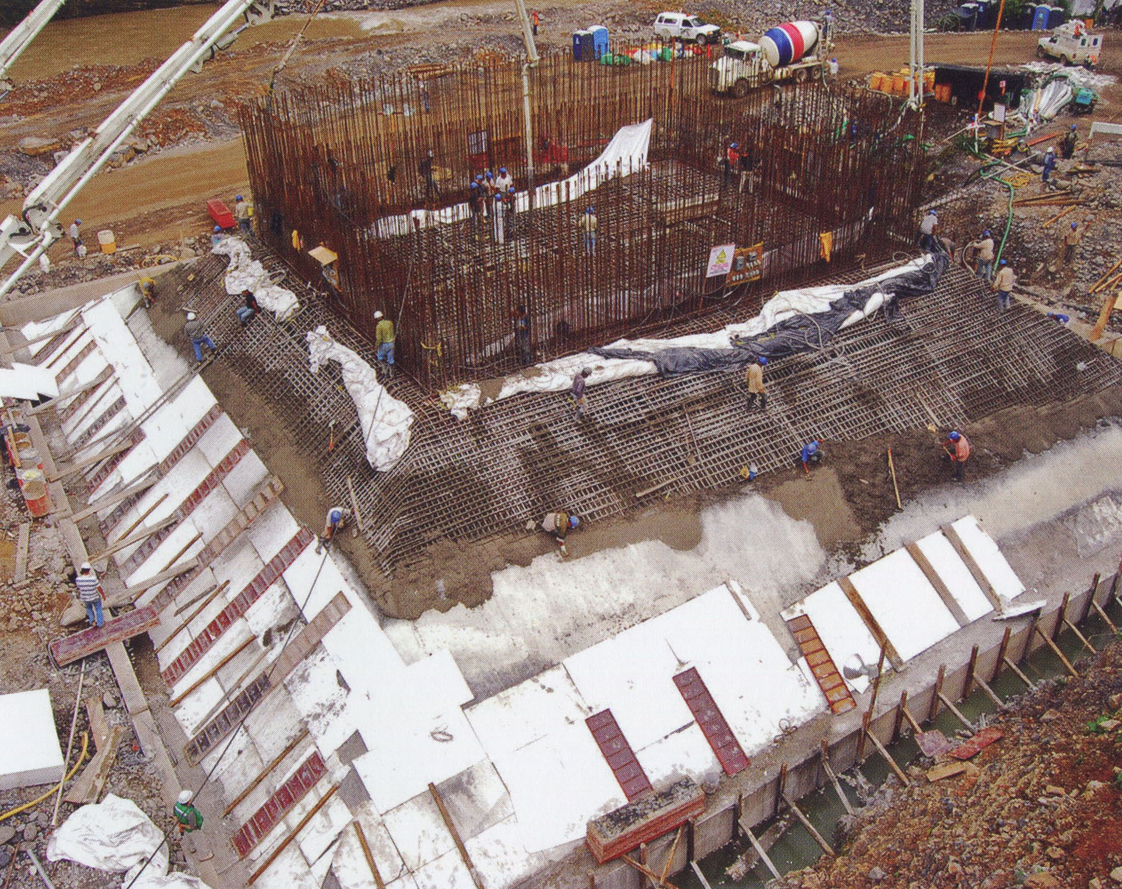
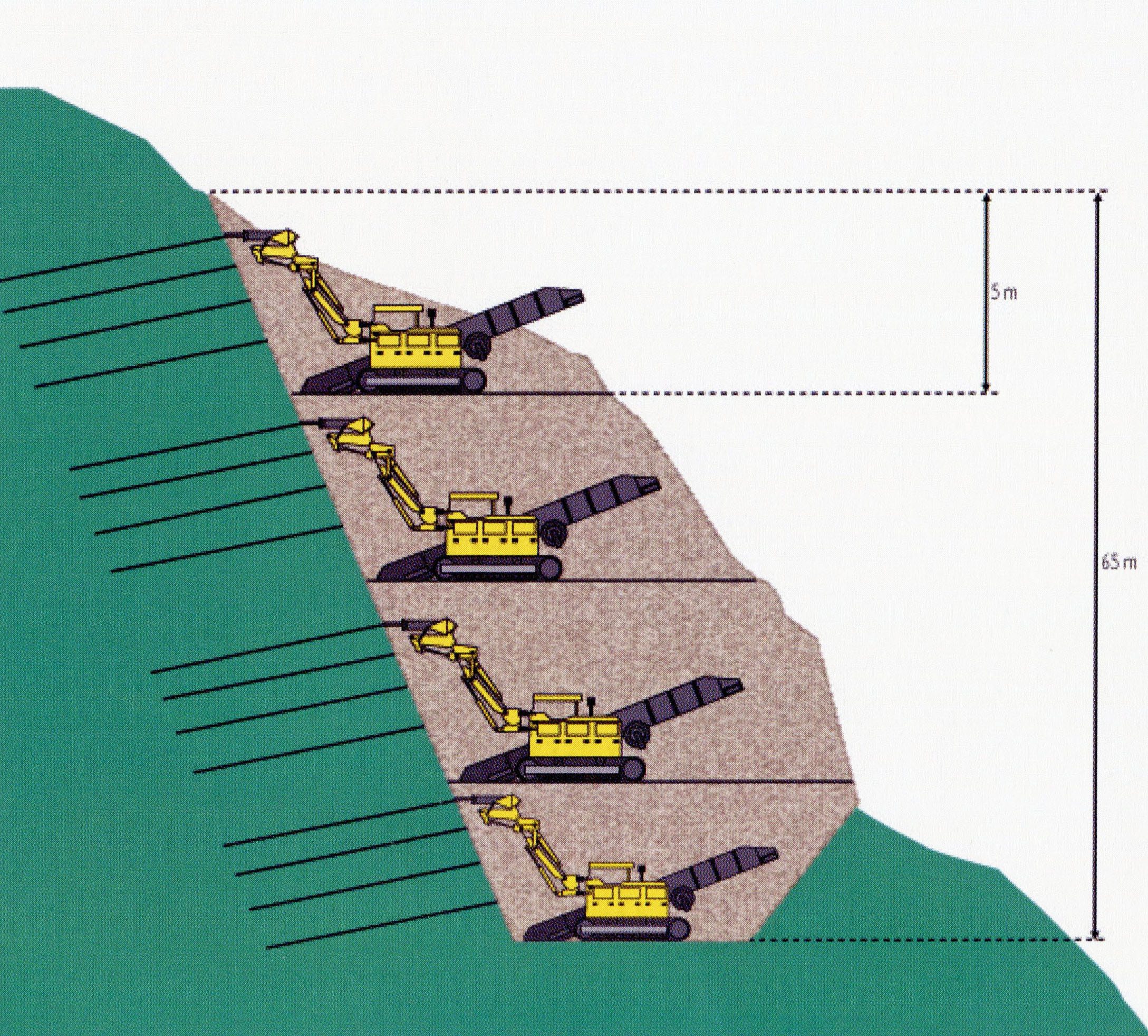
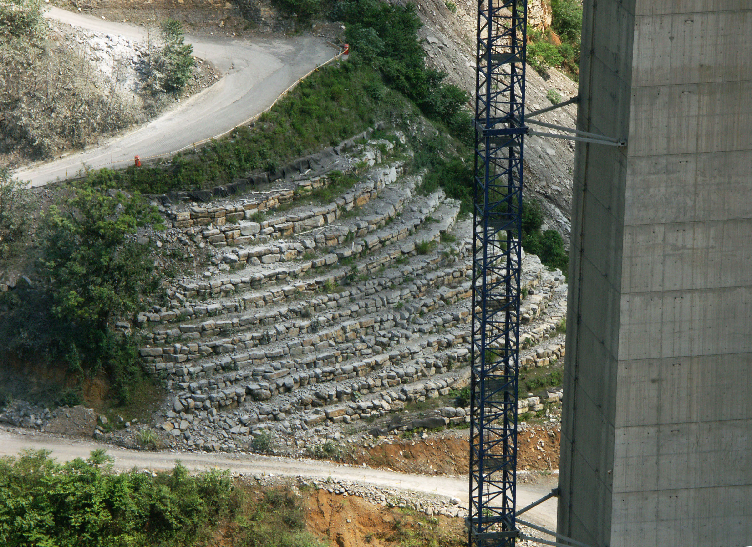
Slope excavation process for one of the piers on San Marcos Bridge. Image by SCT.
Image by Eric Sakowski / HighestBridges.com
Image by Eric Sakowski / HighestBridges.com
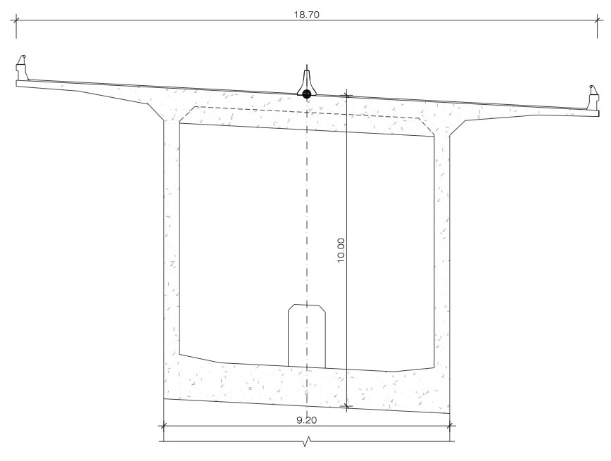
San Marcos Bridge deck cross section.
Image by Eric Sakowski / HighestBridges.com
Image by Eric Sakowski / HighestBridges.com
Image by Eric Sakowski / HighestBridges.com
Image by Eric Sakowski / HighestBridges.com
Image by Eric Sakowski / HighestBridges.com
Image by Eric Sakowski / HighestBridges.com
Image by Eric Sakowski / HighestBridges.com
Image by Eric Sakowski / HighestBridges.com
Image by Eric Sakowski / HighestBridges.com
Image by Eric Sakowski / HighestBridges.com
Image by Eric Sakowski / HighestBridges.com
Image by Eric Sakowski / HighestBridges.com
Image by Eric Sakowski / HighestBridges.com
Image by Eric Sakowski / HighestBridges.com
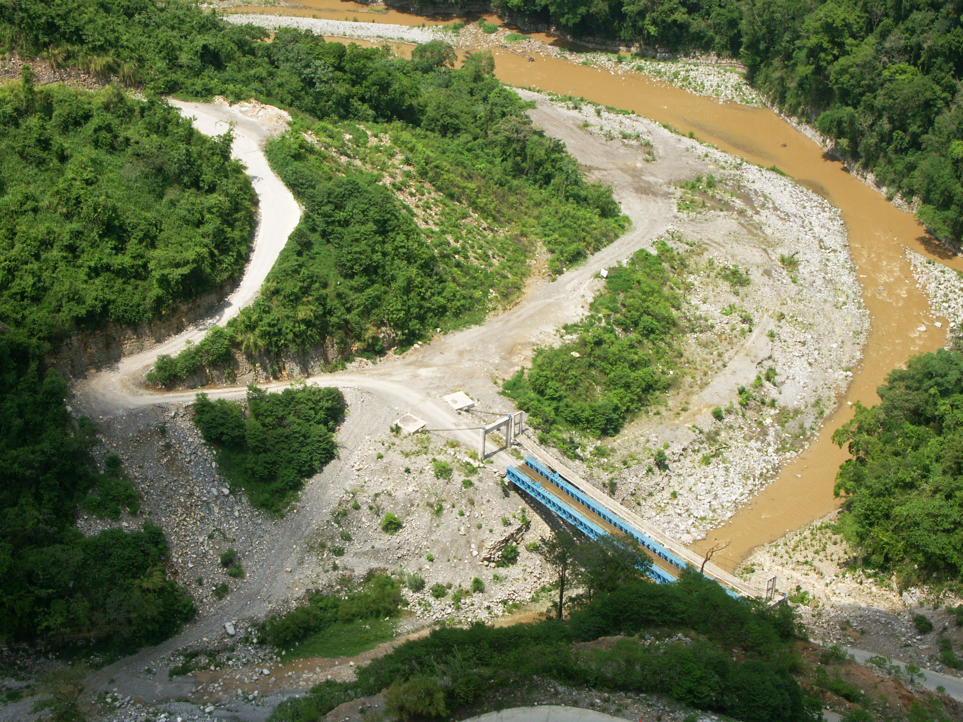
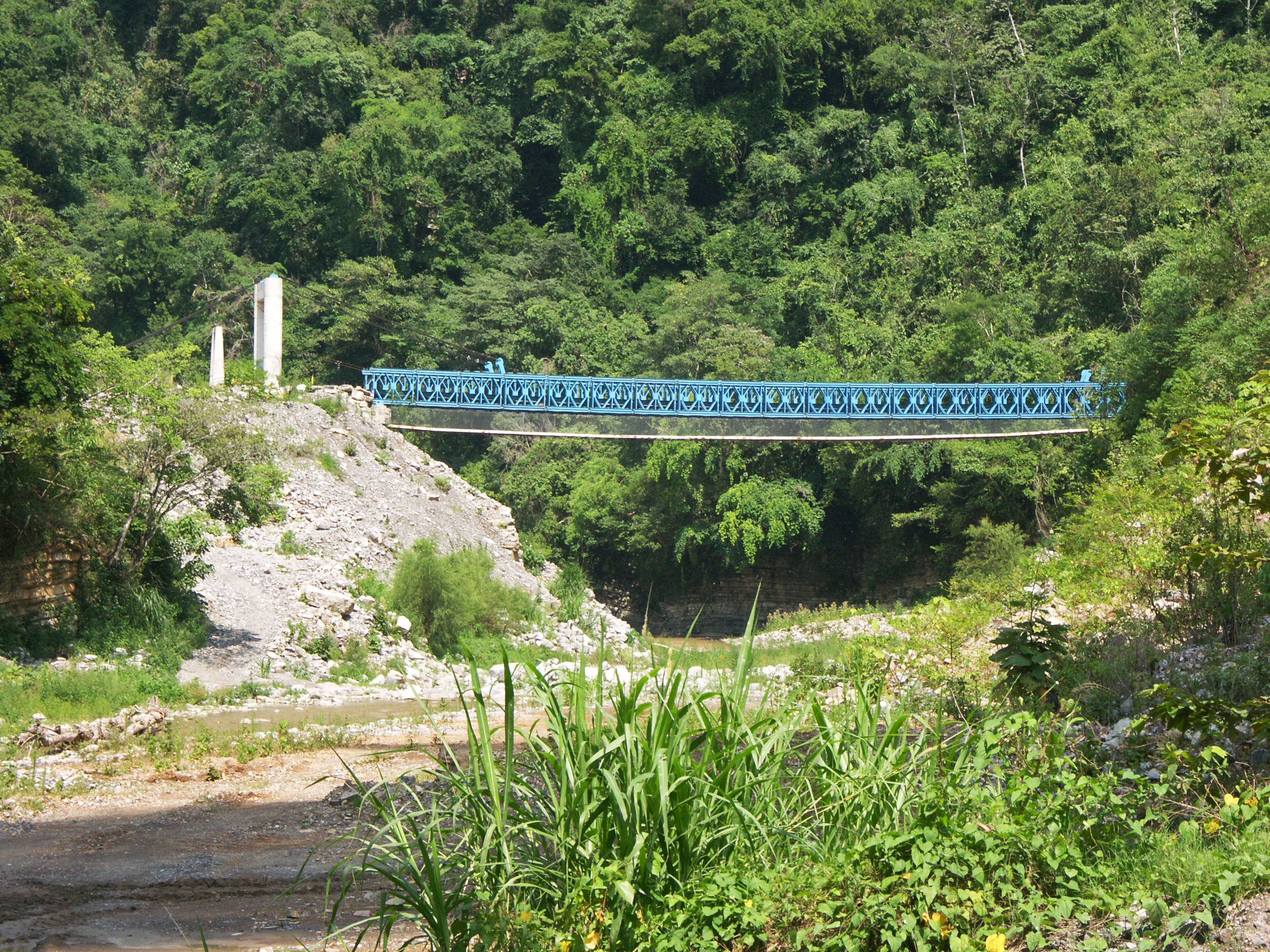
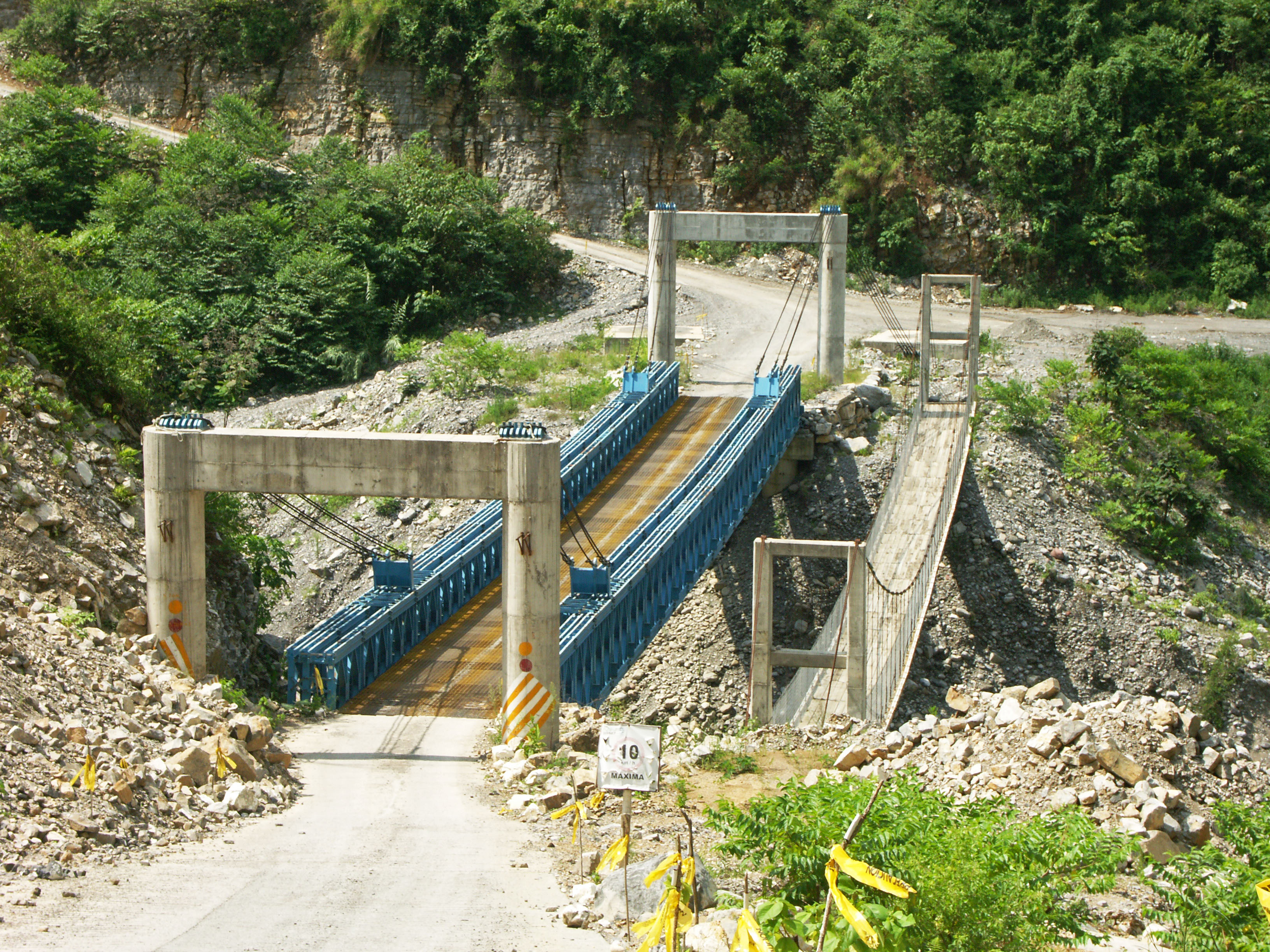
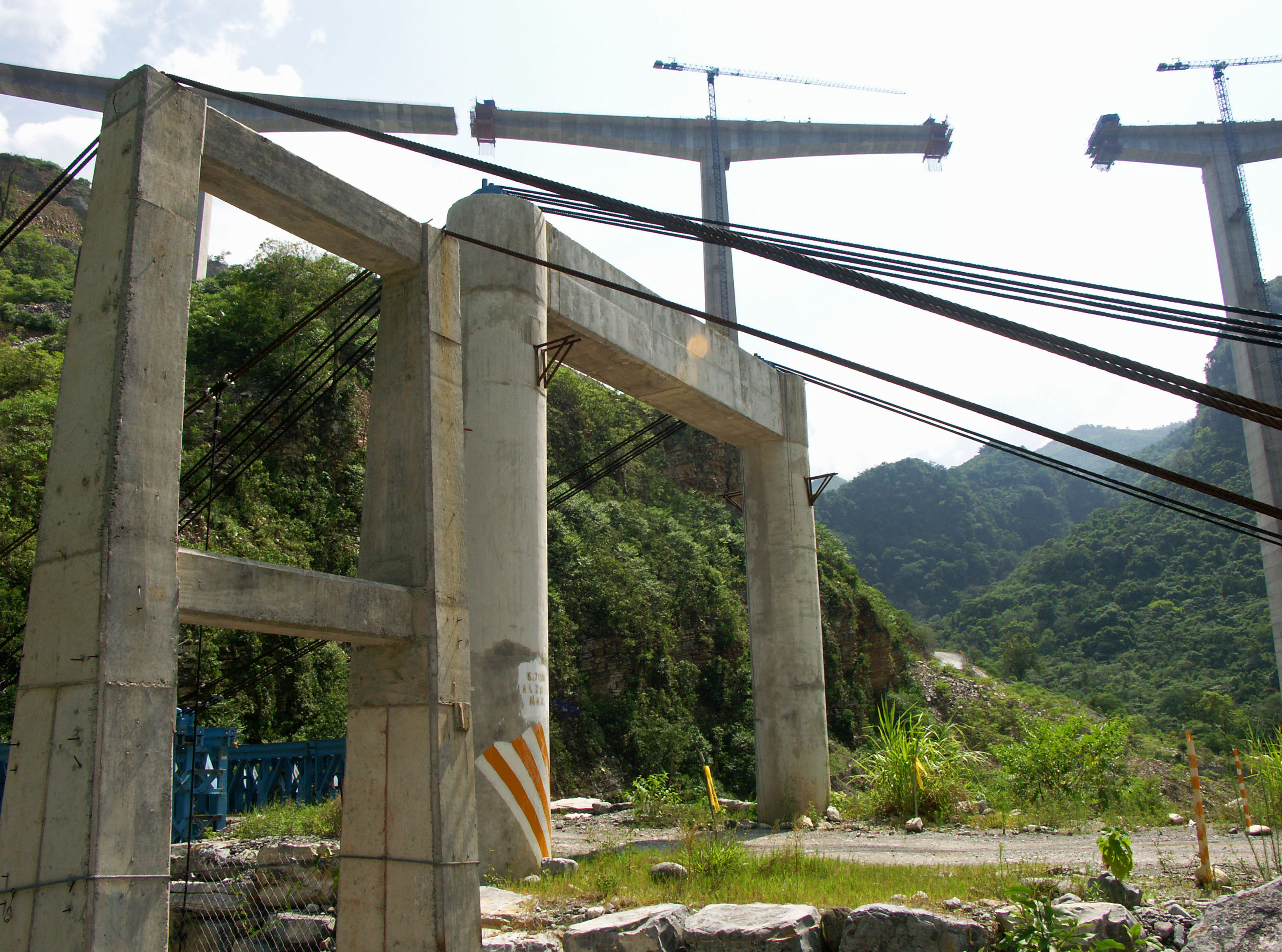
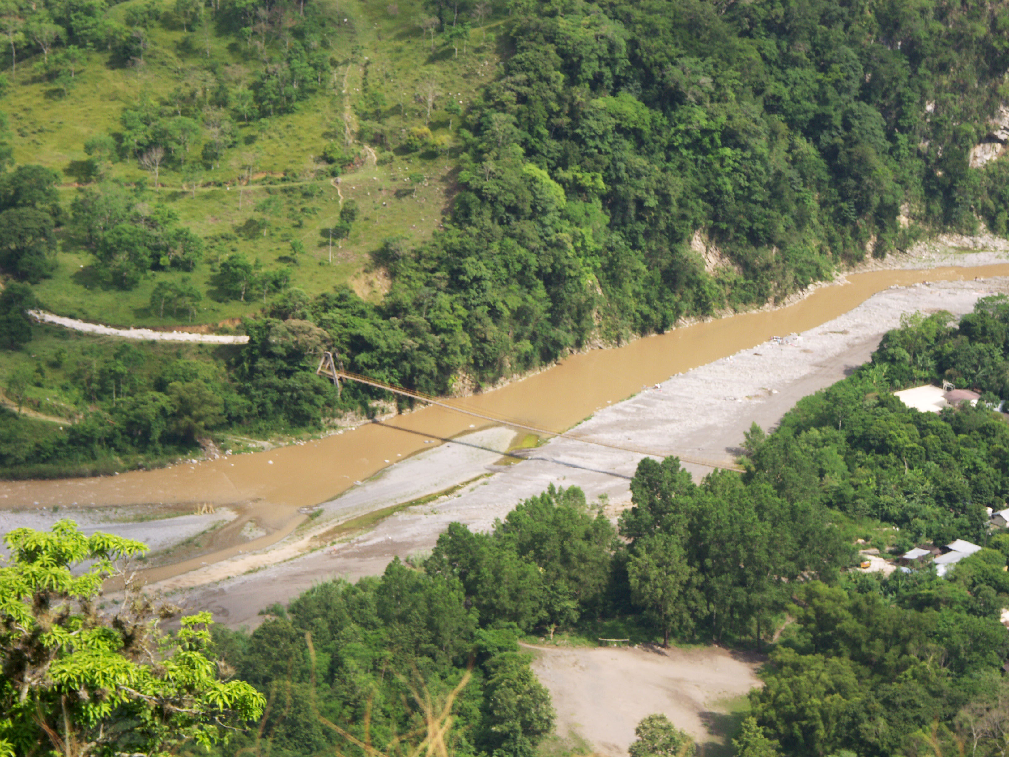
A Bailey type truss bridge with a clear span of approximately 60 meters / 200 feet was built to aid in the construction of the giant highway bridge. A parallel suspension footbridge also crosses the San Marcos River. Both bridges have a tower to tower distance of approximately 70 meters / 230 feet. Image by Eric Sakowski / HighestBridges.com
The Bailey truss is assisted by cable stays though it was interesting to see the cables terminate at the top of the south tower. On the north tower the cables terminate into a ground anchorage. Image by Eric Sakowski / HighestBridges.com
Image by Eric Sakowski / HighestBridges.com
Image by Eric Sakowski / HighestBridges.com
Image by Eric Sakowski / HighestBridges.com
Image by Eric Sakowski / HighestBridges.com
Image by Eric Sakowski / HighestBridges.com
Image by Eric Sakowski / HighestBridges.com
Another long footbridge across the San Marcos River about 1 kilometer downstream of the highway crossing. With a main span of at least 110 meters / 360 feet, this would rank among the 25 longest footbridges in North America. Image by Eric Sakowski / HighestBridges.com
Image by Eric Sakowski / HighestBridges.com
Image by Eric Sakowski / HighestBridges.com
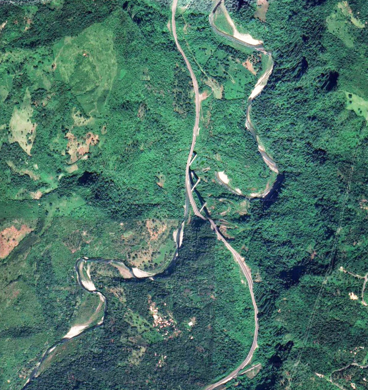
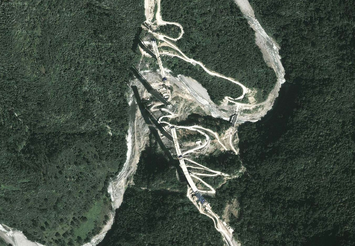
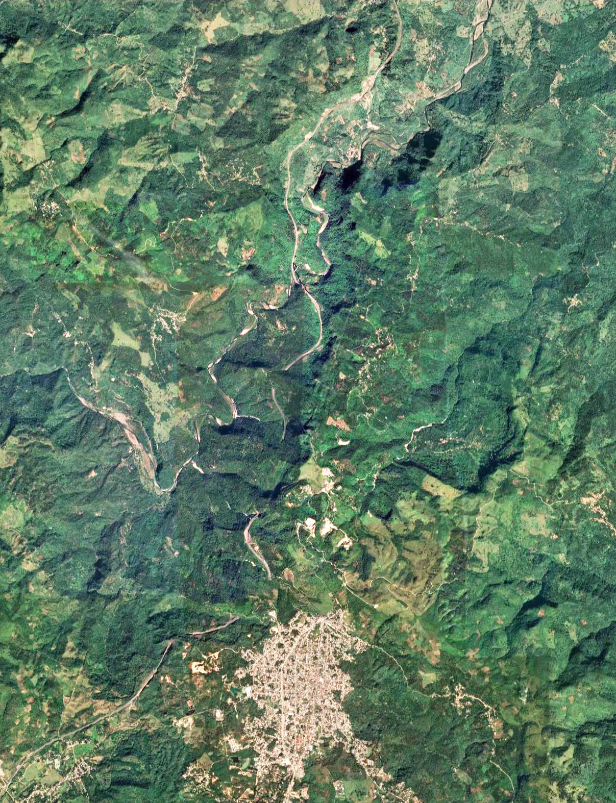
San Marcos Bridge satellite image.
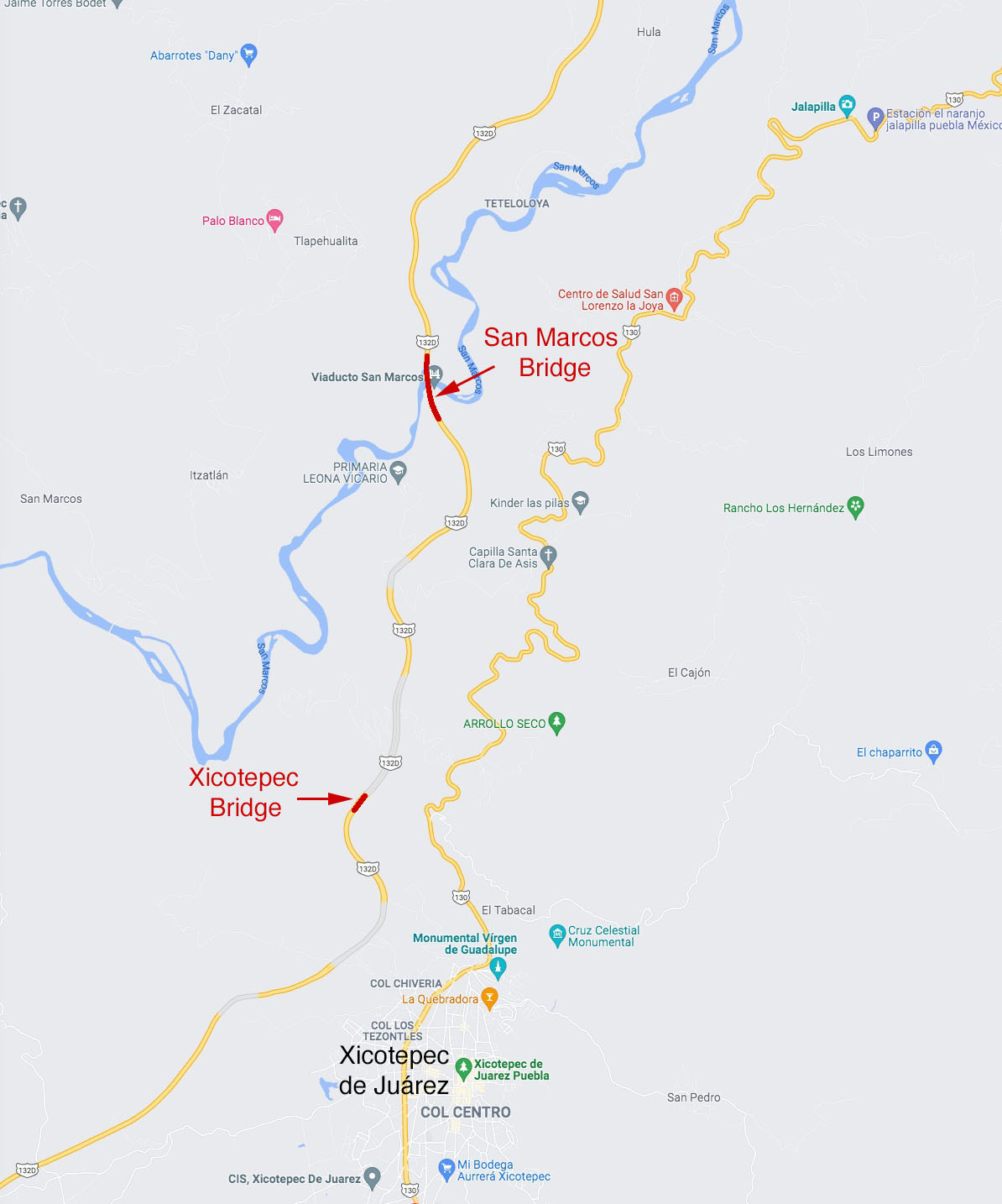
San Marcos Bridge location map.
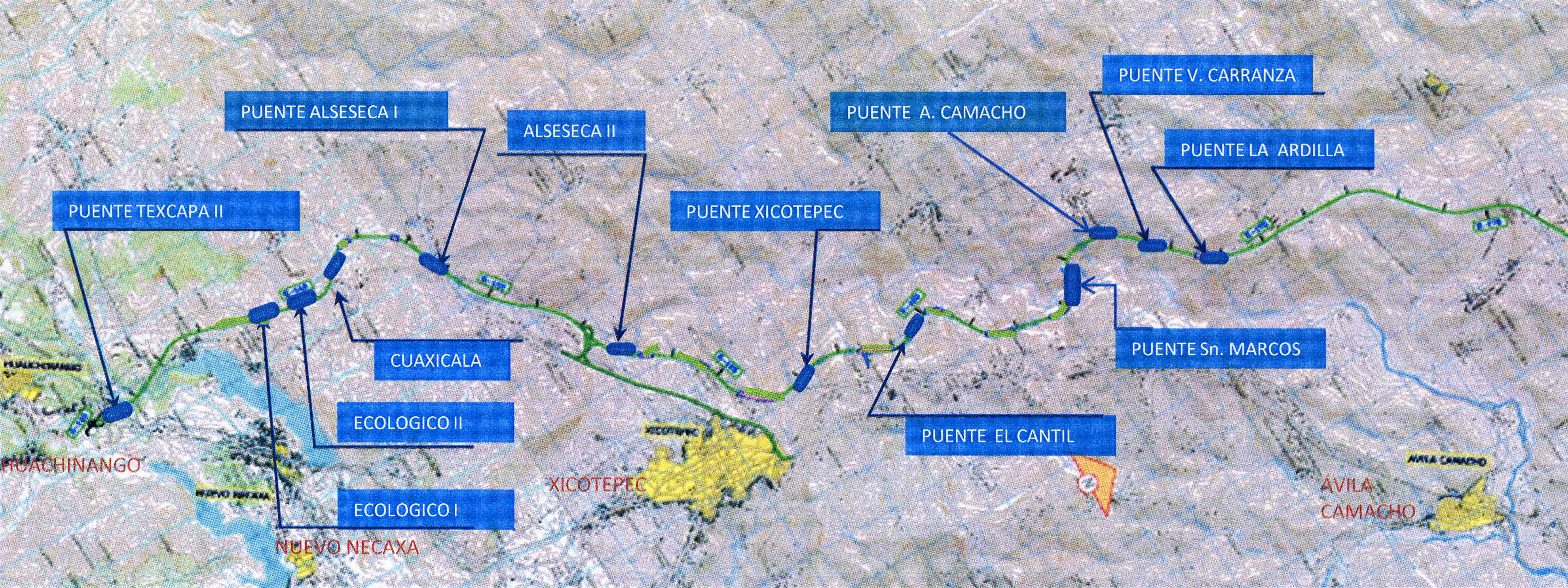
Map of Tuxpan highway bridges between kilometers 839 - 873.
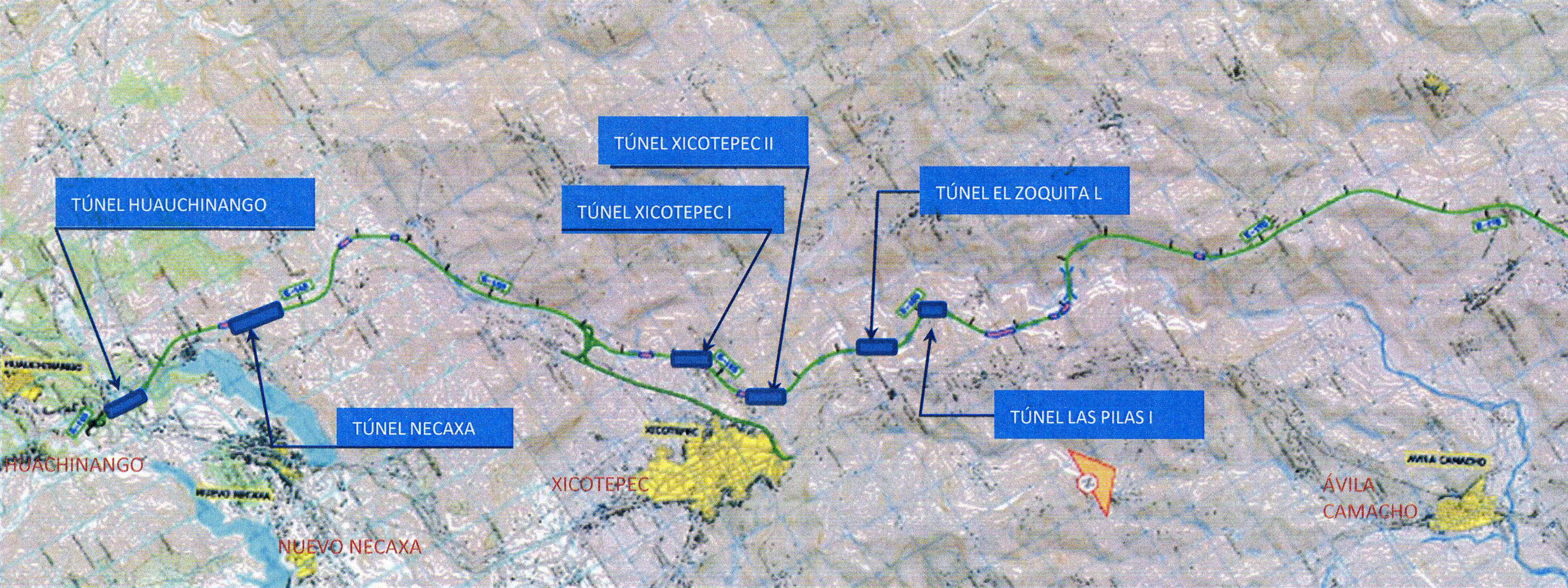
Map of Tuxpan highway tunnels between kilometers 839 - 873.
A map of the most difficult stretch of highway between Nuevo Necaxa and Ávila Camacho.
When completed, the México-Tuxpan highway will connect Mexico City with the Gulf of Mexico 182 miles (293 kms) away.
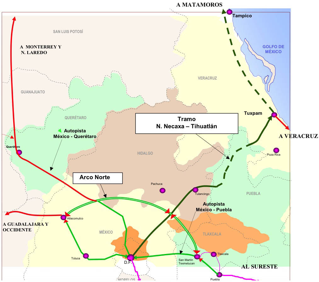
The new carretera will open up new trade routes to the interior of the country as well as Mexico City.
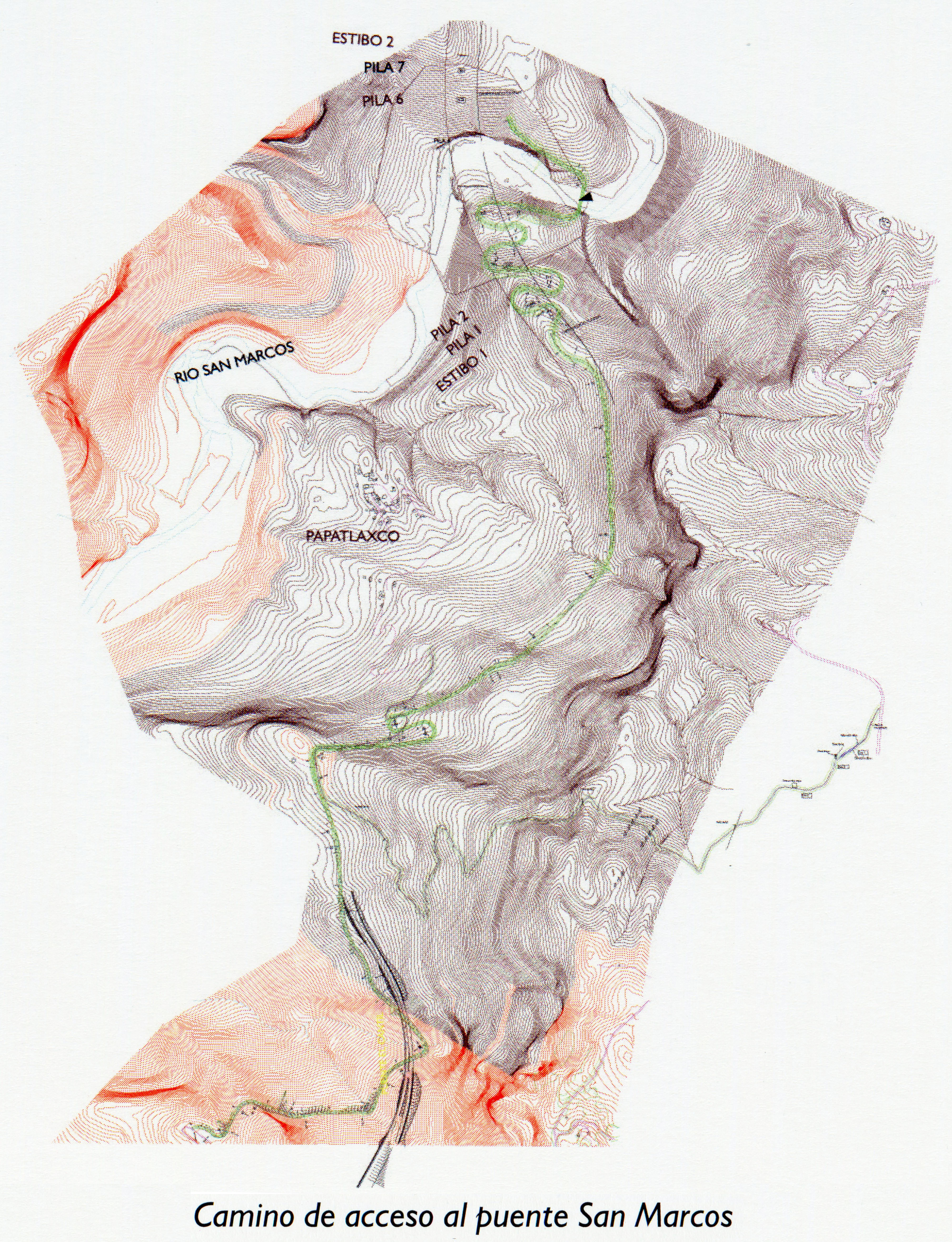
San Marcos Bridge access roads topographic map.
