Canada Bridges 90 to 100 meters
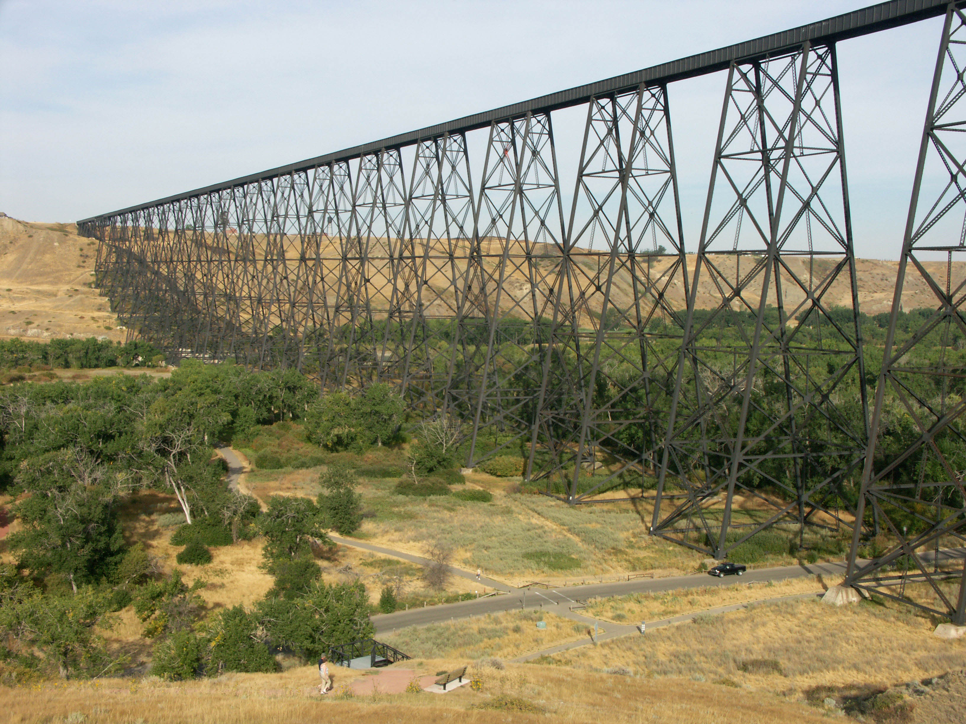
The largest conventional trestle railroad bridge ever built, the mile long Lethbridge Viaduct (94 meters high) opened in 1909 across the Oldman river in the southern Alberta province city of Lethbridge. The crowning achievement of the Canadian Pacific railway, the bridge was actually a bypass to the original route that went south across the St. Mary’s river and over numerous coulees on a series of timber Howe truss trestles that were not built to last more than 10 or 15 years and required constant maintenance. A new direct crossing over the Oldman river shaved 5 miles (8.5 kms) off the original route.
Although the design and construction of Lethbridge was similar to many other trestles, the scale was unprecedented. Most tall railroad bridges have trestle towers that span no more than 45 feet (14 mtrs). On Lethbridge they are 67 feet (20 mtrs) long. The intermediate spans of 97 feet (30 mtrs) were also of a length that was rarely exceeded at the time. The use of partial through plate girder spans was also uncommon. By having part of the girder higher than the rail, it acted as a partial wind buffer. Now 100 years old, the bridge is still heavily used and a vital component of CP’s extensive rail network.
One of 3 high bridges built on the new Mica Dam access road along Lake Revelstoke, Carnes Creek bridge (91 meters high) crosses an inlet that was once a crevasse-like gorge before the waters were backed up by the 574 foot (175 mtr) high Revelstoke dam. Constructed in 1982 approximately 2 years before the completion of the dam, the Carnes Creek bridge is a 4-span steel girder crossing with a cantilevered central beam span. Pier number 2 rises 253 feet (77 mtrs) above the south bank of the gorge. Nearby Mars and La Forme creek bridges are also high, rising 190 feet (58 mtrs) above their old creek levels. Without an artificial lowering of Lake Revelstoke, the full height of these 3 bridges will remain forever unseen.
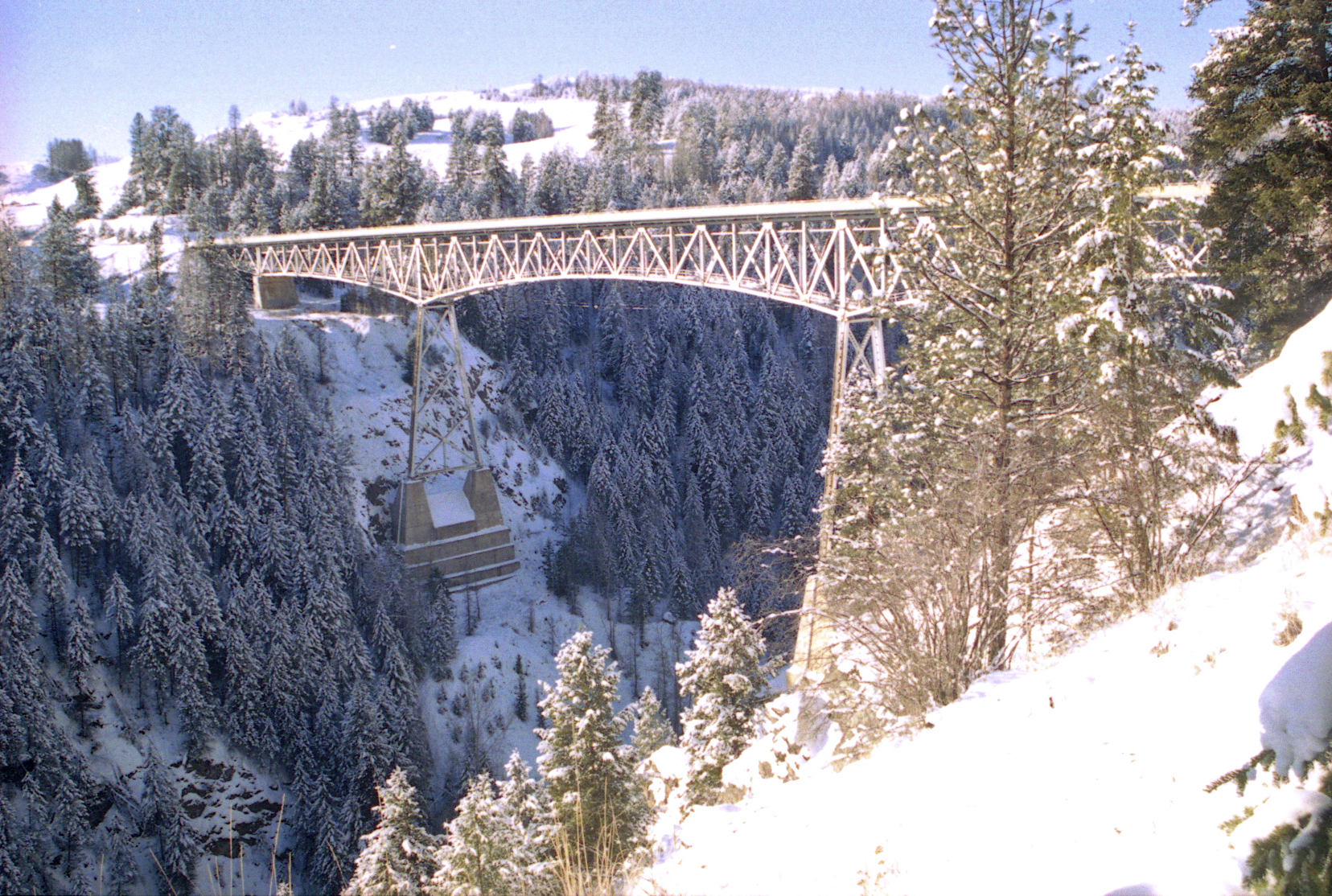
One of the most expensive roads ever built in Canada, the Coquihalla highway 5 is a toll road that extends north through British Columbia from Hope to Kamloops. About 15 miles (24 kms) south of Brookmere is the Dry Gulch bridge (91 meters high), a steel box beam arch completed in 1985 with a main span of 575 feet (175 mtrs). Several hundred feet down the gully are the remains of the Dry Gulch trestle that was part of the famous Kettle Valley railway that once snaked through southern British Columbia before it was abandoned in 1961.
The highest bridge on Canada’s route 3, the Rock Creek Canyon bridge (91 meters high) was completed in 1951 near Bridesville. The 5-span deck truss has a central river span of 309 feet (94 mtrs) that rests on piers supported by layered foundations that look like a wedding cake. In 1992, B.C. engineers Buckland & Taylor renovated the bridge with a wider and stronger deck. Route 3 skirts along the southern border of British Columbia.
The highest arch bridge and the second highest bridge overall on Canada’s 646 mile (1,039 km) Trans-Canada Highway 1, the Nine Mile Canyon or Ainsle Creek Bridge (91 meters high) is a steel truss-arch with a main span of 480 feet (146 mtrs). Located along the eastern slope of the deep Fraser River canyon near Boston Bar, the bridge parallels the CN rail line more than a hundred feet lower down. Constructed in 1958, the bridge was part of an overall improvement to the highway which once crossed Ainsle Creek on a much lower timber bridge. The recently constructed Park (10 mile) bridge east of Golden is the highest bridge on Highway 1 crossing 322 feet (98 mtrs) above the Kicking Horse River.
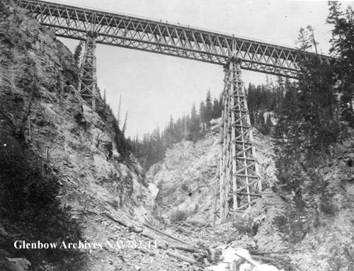
The highest timber bridge ever built and the second highest bridge in North America at the time of its completion in 1885, the original Stoney Creek bridge (90 meters high) carried the upper line of the Canadian Pacific across a deep gully along its route through what is now Glacier National Park in British Columbia near Rogers Pass. No other railway in the history of North America built as many high timber bridges as the Canadian Pacific did in on its initial run through the Canadian Rockies. Like all of the large bridges on the CP, Howe trusses were used for the main spans. For Stoney Creek, they measured 172 feet (52 mtrs) and 161.5 feet (49 mtrs). Both spans partially rested on a central pier 196 feet (60 mtrs) feet high. Like so many railways of the age, the timber bridges were never meant to be permanent, only a quick way to get the line open before more substantial steel structures could replace them. In 1894 it was finally replaced with a 336 foot (102 mtr) steel arch span. No other timber bridge would ever be built as high as the first Stoney Creek bridge. Nearby Mountain Creek and Surprise Creek were the second and third highest timber bridges on the CP mainline. Steel trestles replaced Surprise Creek in 1894 and Mountain Creek in 1902. For those who were wondering, the Kinzua railway viaduct in the U.S. state of Pennsylvania was the highest North American bridge throughout the 1880s.
A replacement for the famous Howe truss timber bridge of 1885, the 1894 Stoney Creek arch bridge (90 meters high) spans 336 feet (102 mtr) between two rocky cliffs in Glacier National Park in British Columbia. Years later the bridge was reinforced for heavier locomotives by adding another truss-arch rib next to each of the two original ribs as well as replacing the deck truss spans with smaller girder spans and increasing the number of spandrel supports. The arch uses 524 tons of steel out of a total weight of 771 tons.
A big, beautiful blue arch, the Paulson bridge (84 meters high) is located on British Columbia’s east-west highway 3 which runs just north of the U.S. border. The main arch has fixed ends and consists of two steel box girder ribs that span 520 feet (158 mtrs). The bridge crosses over McRae Creek as well as the old grade of the famous Kettle Valley railway which has now become a popular rail trail. You can see the bridge from below by accessing the Kettle Valley trail. Drive 2 miles (3.2 kms) north on route 3 and turn left onto a dirt access road that leads back towards McRae creek. The Paulson bridge is located 10 miles (16 kms) north of Christina Lake, British Columbia.


