Difference between revisions of "File:MazMapOrig.jpg"
From HighestBridges.com
Jump to navigationJump to search (Map of the Mazatlan-Durango highway showing the location of the 10 highest bridges and many of the 63 tunnels. The Neverias, La Pinta and Rio Chico bridges were completed between 2005 and 2008 and open to traffic. The rest of the highway will open in 20) |
(No difference)
|
Latest revision as of 23:17, 19 September 2009
Map of the Mazatlan-Durango highway showing the location of the 10 highest bridges and many of the 63 tunnels. The Neverias, La Pinta and Rio Chico bridges were completed between 2005 and 2008 and open to traffic. The rest of the highway will open in 2012.
File history
Click on a date/time to view the file as it appeared at that time.
| Date/Time | Thumbnail | Dimensions | User | Comment | |
|---|---|---|---|---|---|
| current | 23:17, 19 September 2009 | 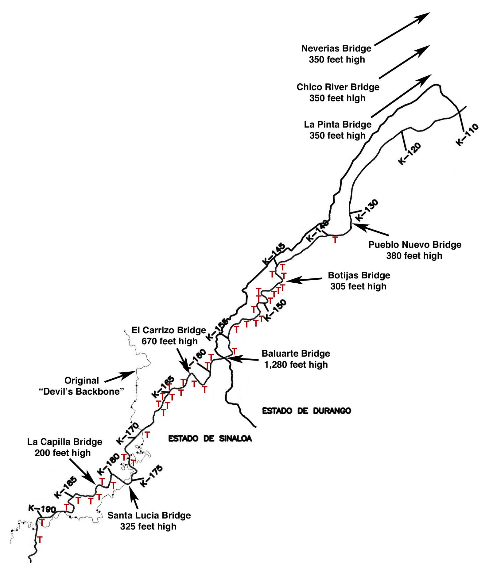 | 1,606 × 1,872 (216 KB) | Sakowski (talk | contribs) | Map of the Mazatlan-Durango highway showing the location of the 10 highest bridges and many of the 63 tunnels. The Neverias, La Pinta and Rio Chico bridges were completed between 2005 and 2008 and open to traffic. The rest of the highway will open in 20 |
You cannot overwrite this file.
File usage
There are no pages that use this file.